Weir angle (Water Overlay): Difference between revisions
Jump to navigation
Jump to search
mNo edit summary |
No edit summary |
||
| Line 1: | Line 1: | ||
[[File:Weir_angle_explain_(Water_Overlay).png|thumb|right|x300px]] | [[File:Weir_angle_explain_(Water_Overlay).png|thumb|right|x300px]] | ||
[[File: | [[File:Set_Multi_Weir_value.jpg|thumb|right|x300px]] | ||
{{Overlay keys|<onlyinclude> | {{Overlay keys|<onlyinclude> | ||
{{Overlay keys|type=row|group=Water Overlay | {{Overlay keys|type=row|group=Water Overlay | ||
Revision as of 07:46, 14 July 2021
| Icon | Key | Unit | Range | Description | Default value |
|---|---|---|---|---|---|
| |
WEIR_ANGLE | geo angle (0-360°) | The top down orientation angle of the weir. | 0 |
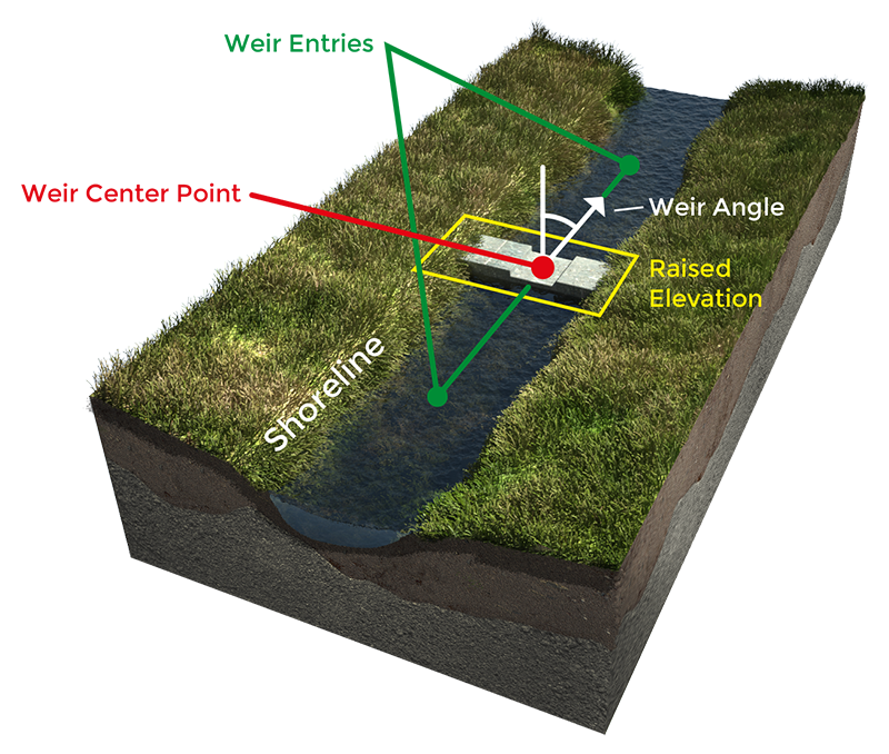
The weir angle is used to convert a weir loaded in as point-based data to a line which is used in the simulation to define from where to where the water should flow across the weir. It also automatically adjusts the elevation perpendicular to the direction of the weir, so that water can only flow from one side of the weir to the other through the weir, rather than around it.
Notes
- The width of the generated dam is equal to the weir's WEIR_WIDTH, multiplied by the WEIR_DAM_MULTIPLIER of the Water Overlay.
- If a weir angle is available for a weir which is already line-shaped, the weir is first interpreted as a point, and then the direction and elevation are adjusted accordingly. The centre of the weir's polygon is used.
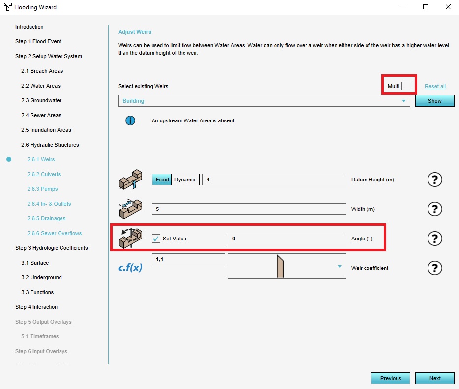
- If no angle is available as an attribute, the angle can be calculated by using the Generate Angles option in the Weirs step of the wizard.


