Weir angle (Water Overlay): Difference between revisions
Jump to navigation
Jump to search
No edit summary |
No edit summary |
||
| Line 1: | Line 1: | ||
{{overlay attribute | {{overlay attribute | ||
| | |key=[[Weir_angle_(Water_Overlay)|WEIR_ANGLE]] | ||
|unit={{geoangle}} | |unit={{geoangle}} | ||
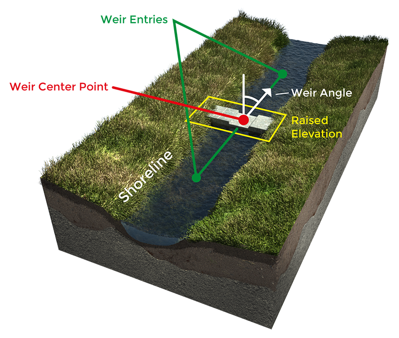
|description=The top down orientation angle of the weir. | |description=The top down orientation angle of the weir. | ||
Revision as of 13:20, 29 November 2019
Notes
- This angle is used to generate a line for the front and back entries of the weir. Additionally, the elevation is also automatically adjusted for the region perpendicular to the weir angle.
- If no angle is available as an attribute, the angle can be calculated.


