Travel Distance Overlay: Difference between revisions
| Line 18: | Line 18: | ||
===Grid Prequels=== | ===Grid Prequels=== | ||
It is also possible to provide certain input data as more detailed grid. The following data can be provided as prequel [[Grid Overlay | It is also possible to provide certain input data as more detailed grid. The following data can be provided as prequel [[Grid Overlay]]s: | ||
* [[Destination prequel (Travel Distance Overlay)|DESTINATION]]: Provides an alternative for the destination grid locations. Overrides the default, which are [[ | * [[Destination prequel (Travel Distance Overlay)|DESTINATION]]: Provides an alternative for the destination grid locations. Overrides the default, which are [[Destination area feature (Travel Distance Overlay)|destination areas]]. | ||
* [[Traversable prequel (Travel Distance Overlay)|TRAVERSABLE]]: Provides an alternative for the traversable grid locations. Overrides the default, which are traversable roads which allow the [[Model attributes (Travel Distance Overlay)|traffic of interest]]. | * [[Traversable prequel (Travel Distance Overlay)|TRAVERSABLE]]: Provides an alternative for the traversable grid locations. Overrides the default, which are traversable roads which allow the [[Model attributes (Travel Distance Overlay)|traffic of interest]]. | ||
* [[Blocking prequel (Travel Distance Overlay)|BLOCKING]]: Provides an alternative for the non-traversable grid locations. Overrides the blocking features configured using [[ | * [[Blocking prequel (Travel Distance Overlay)|BLOCKING]]: Provides an alternative for the non-traversable grid locations. Overrides the blocking features configured using [[Blocked (Travel Distance Overlay)|BLOCKED]]. | ||
===Result Types=== | ===Result Types=== | ||
Revision as of 12:04, 5 July 2023
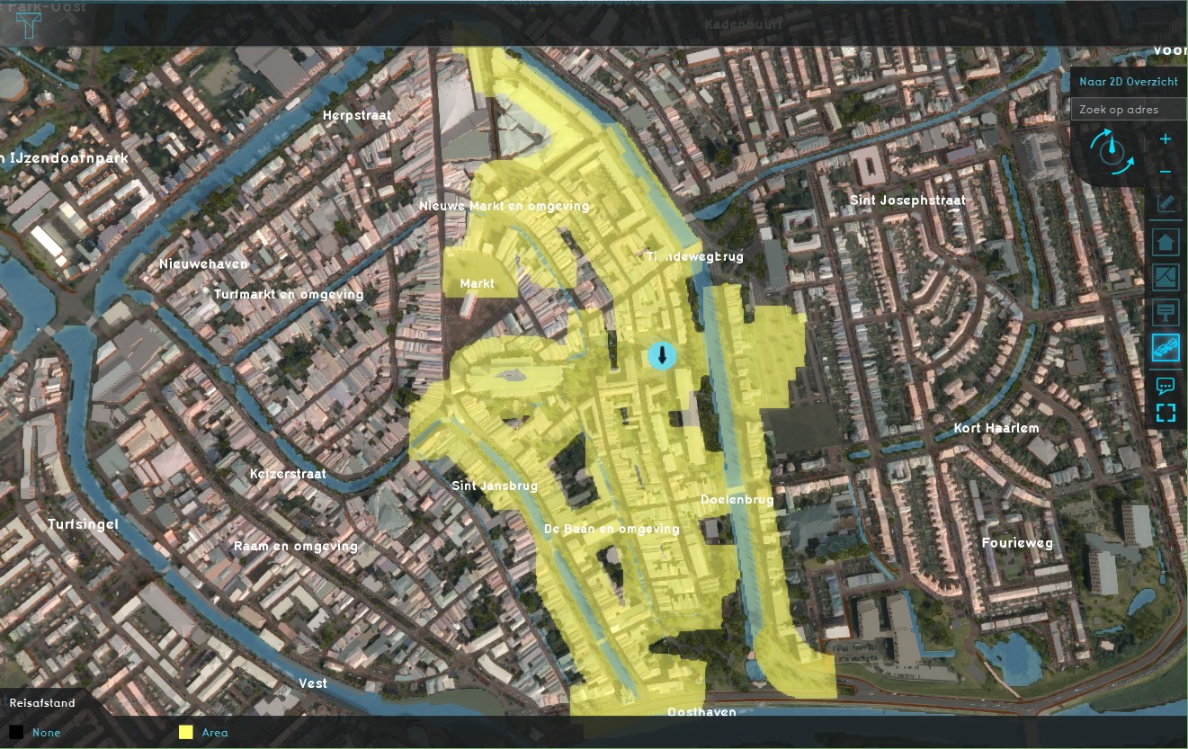
The Travel Distance Overlay is a grid overlay which shows the distance that can be traveled from a certain starting point (destination area). The traffic is split between motorized and pedestrian traffic, based on the road type (roads vs sidewalks).
The overlay also uses an additional fill distance, which allows the result to expand to the area around the accessible roadways, to include accessible surrounding constructions. This allows users to query constructions that are within acceptable distance of cells which are within the travel distance.
The calculation model behind the overlay is based on the same algorithm as used in the Watershed Overlay. The travel distance will therefore not be the exact travel distance, but the 8-direction Chebyshev distance.
Example
The travel distance overlay can be used to visualize the travel distance from certain areas of interest (schools, shops, sports centers, etc), based on the roads project area. If we take a school as example, we can visualize which houses (and other buildings), within a range of 20m to a connecting sidewalk, are within a walking distance of 500m from the school of the example.
Keys
Attributes
Grid Prequels
It is also possible to provide certain input data as more detailed grid. The following data can be provided as prequel Grid Overlays:
- DESTINATION: Provides an alternative for the destination grid locations. Overrides the default, which are destination areas.
- TRAVERSABLE: Provides an alternative for the traversable grid locations. Overrides the default, which are traversable roads which allow the traffic of interest.
- BLOCKING: Provides an alternative for the non-traversable grid locations. Overrides the blocking features configured using BLOCKED.
Result Types
Distance result type (Travel Distance Overlay)
| Icon | Result type | Unit | Mode | Description |
|---|---|---|---|---|
| |
BASE_TYPES | Total | The types of cells used in the Travel Distance Overlay's calculation of distances to the closest destination area. |
Notes
- This method does not take into account driving lane and one-direction limitations.
How-to's
