Rain area (Water Overlay): Difference between revisions
Jump to navigation
Jump to search

No edit summary |
No edit summary |
||
| (2 intermediate revisions by the same user not shown) | |||
| Line 4: | Line 4: | ||
{{:rain m (Water Overlay)}} | {{:rain m (Water Overlay)}} | ||
}} | }} | ||
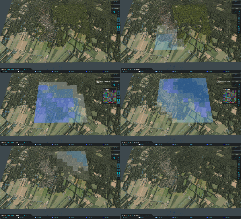
[[File:Wateroverlay_rainfall_areas_dynamic.gif|left|frame|Dynamic rainfall defined by 101 different rain areas, which is shown in the mini-map halfway the animation. Animation is showing the [[Last rain result type (Water Overlay)|last rain result]]]] | |||
{{article end | {{article end | ||
| Line 17: | Line 20: | ||
* [[Rain result type (Water Overlay)]] | * [[Rain result type (Water Overlay)]] | ||
* [[Last rain result type (Water Overlay)]] | * [[Last rain result type (Water Overlay)]] | ||
* [[Rain model (Water Overlay)]] | |||
|howtos= | |howtos= | ||
* [[How to create a Rain area]] | * [[How to create a Rain area]] | ||
}} | }} | ||
{{WaterOverlay hydrological features nav}} | {{WaterOverlay hydrological features nav}} | ||
Latest revision as of 12:25, 1 March 2024
A Rain area is a feature which can override the Weather's rain with a different array of values. This allows users to simulate rain clouds moving over the project area.
| Icon | Key | Unit | Range | Description | Default value |
|---|---|---|---|---|---|
| |
RAIN_M | end-time, m | An array of values, each pair indicating until what time that period of rain will last and how much rain will fall in that period. | n/a |

Dynamic rainfall defined by 101 different rain areas, which is shown in the mini-map halfway the animation. Animation is showing the last rain result
Notes
- A maximum of 10.000 values (5.000 pairs) can be defined per rain area.
- Up to 32.000 rain areas per Water Overlay are supported.
- It's not required to fill the entire project area with Rain areas to use the Rain area functionality. For locations without a Rain area, the Weather's rain m is applied.
- See the RAIN_M attribute for more information on the restriction on its values.
How-to's
See also


