Flooding Overlay: Difference between revisions
Jump to navigation
Jump to search
No edit summary |
No edit summary |
||
| Line 1: | Line 1: | ||
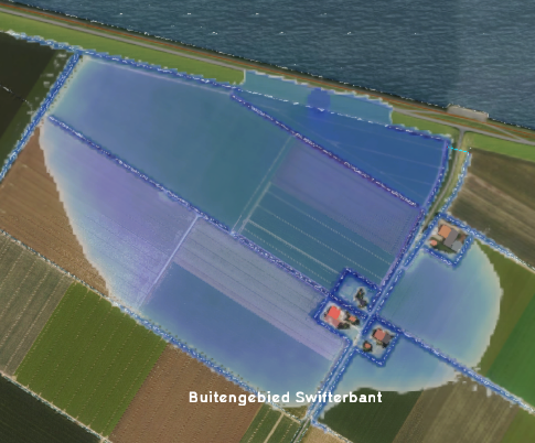
[[File:FloodingOverlay2.png|right|thumb|200px|Flooding overlay]] | [[File:FloodingOverlay2.png|right|thumb|200px|Flooding overlay]] | ||
The Flooding overlay | The Flooding Overlay is a variant of the [[Water Overlay]], which in turn is a [[Grid overlay|grid overlay]]. Water overlays are connected to the [[Water Module]], a complex hydrological calculation module within the {{software}}. | ||
The Flooding overlay calculates and visualizes the movement of water over land in combination with a [[Breach|breach]] or other [[Inlet|inflow]] of water in the project [[Water area|water area(s)]]. | |||
<ul> | <ul> | ||
Revision as of 08:20, 10 April 2019
The Flooding Overlay is a variant of the Water Overlay, which in turn is a grid overlay. Water overlays are connected to the Water Module, a complex hydrological calculation module within the Tygron Platform.
The Flooding overlay calculates and visualizes the movement of water over land in combination with a breach or other inflow of water in the project water area(s).
Flooding overlay results
Flooding overlay results
List of Result Types
