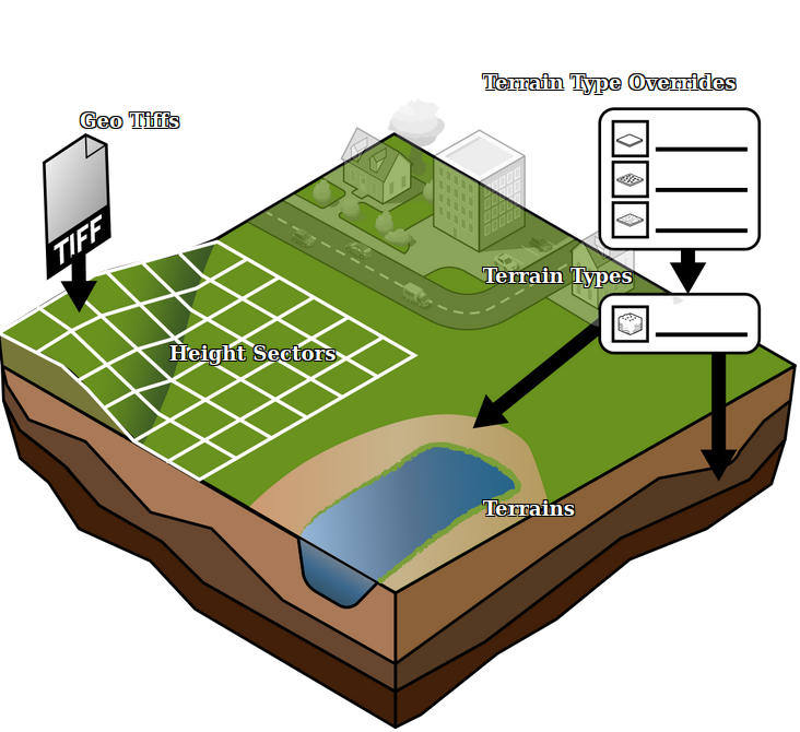
Terrain
The composition of the surface (above-ground) and sub-surface (underground) in the Project is defined using Terrains. A Terrain has a polygons indicating its boundaries and a Terrain Type indicating its type. For every location in the project, two terrains will be present: one surface layer Terrain and one underground Terrain.
Terrain Type
- Main article: Terrain Type
The Terrain polygons each have an associated Terrain Type, which holds the actual data of what the Terrain polygon represents. Only the Terrain Type holds any Attributes to define the Terrain's behavior.
Terrain elevation
- Main article: Elevation model
Although conceptually related, the height of the Terrain is explicitly not part of the Terrain itself or of the Terrain Types. Instead, based on the presence or selection of specific Terrain Types, modifications to the elevation model are made. For example, replacing a terrain with a type of water will cause a change for the elevation model, but that change can be suppressed.
Terrains define what Terrain Type is present for any given location, and thus how the ground behaves. The elevation model defines the height of the ground for any given location.
Notes
- When creating a new project in the Netherlands, the default Terrains and their Terrain Types are based on data from the BRO.
- Terrains are never edited directly. Instead, users draw or import geometries for alternative Terrain Types.
How-to's
- How to manually change the Terrain
- How to import a GeoJSON of waterways
- How to import a GeoTIFF of waterway depths
