Avg terrain width m (Water Overlay): Difference between revisions
Jump to navigation
Jump to search
No edit summary |
No edit summary |
||
| (2 intermediate revisions by the same user not shown) | |||
| Line 13: | Line 13: | ||
<gallery mode=nolines> | <gallery mode=nolines widths=300px heights=200px> | ||
File:Wateroverlay_avg_terrain_width_1000m.png|Water Overlay | File:Wateroverlay_avg_terrain_width_1000m.png|[[Water Overlay]] set to [[Surface water (Water Overlay)|Grid Averaging Terrains]] and a configured average terrain width of 1000m. | ||
File:Wateroverlay_avg_terrain_width_100m.png|Water Overlay | File:Wateroverlay_avg_terrain_width_100m.png|[[Water Overlay]] set to [[Surface water (Water Overlay)|Grid Averaging Terrains]] and a configured average shore width of 100m. | ||
File:Wateroverlay_difference_waterlevel_avg_terrain_width.png|Difference in [[Surface last value result type (Water Overlay)|water level]]. | File:Wateroverlay_difference_waterlevel_avg_terrain_width.png|Difference in [[Surface last value result type (Water Overlay)|water level]]. | ||
</gallery> | </gallery> | ||
Latest revision as of 16:05, 29 January 2024

| Icon | Attribute | Unit | Range | Description | Default value |
|---|---|---|---|---|---|
| |
AVG_TERRAIN_WIDTH_M | m | 0 to 10000 grid cells | With the surface water mode set to Avg Terrain, identified water average areas can be extended to include surrounding terrain within the configured distance. | 1000 |
This allows water on land to be averaged with the waterways. Water on land that can be averaged has to be higher than the configured AVG_TERRAIN_STORAGE_M.
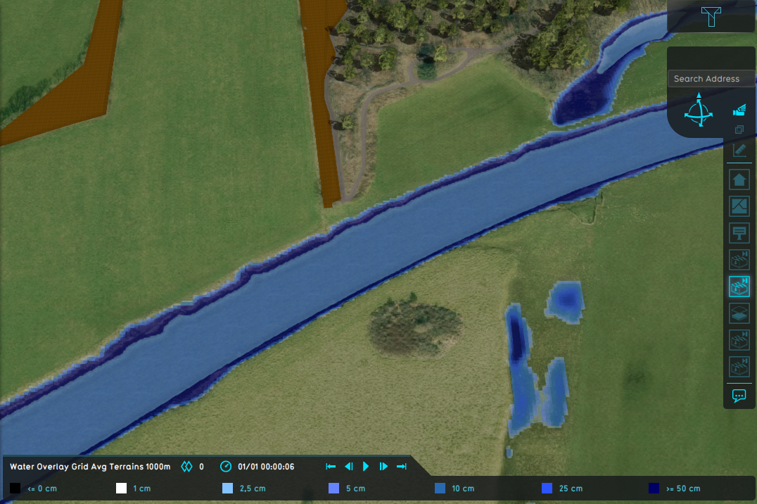
Water Overlay set to Grid Averaging Terrains and a configured average terrain width of 1000m.
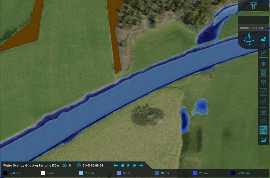
Water Overlay set to Grid Averaging Terrains and a configured average shore width of 100m.
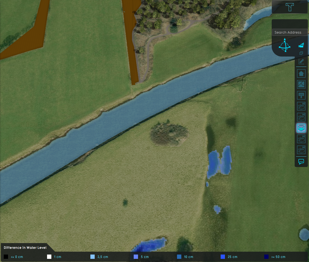
Difference in water level.


Notes
- This option is only used when the surface water mode is set to Avg Terrain.
- As indicated by the range, the average terrain width is converted to a grid cell amount; the average terrain width is divided by the grid cell size.
How-to's


- Group
- Model attributes
- Allowed water increase m • Avg shore width m • Avg terrain width m • Avg terrain storage m • Breach measurement distance m • Bridge elevation • Culvert dem threshold m • Design flood elevation m • Extended reconstruction • Ground bottom distance m • Ground bottom pressure m • Ground water • Ground water depth m • Ground watertable with surface • Impact flood threshold m • Impact range m • Increased resolution • Infiltration factor s
- Limit area • Limit rain • Max infiltration m • Max water bottom m • Microrelief storage fraction • Min max elevation • Object entry correction • Prequel surface level relative • Rise rate distance m • Sewer overflow threshold • Shoreline • Show duration flood level m • Stabilizer angle • Start date ms • Surface water • Surface water evaporation factor • Timeframe times • Timeframes • Unsaturated fraction • Weir dam multiplier • Weir move interval s • Weir move range m • Weir move step m
- Related