Avg terrain width m (Water Overlay): Difference between revisions
Jump to navigation
Jump to search
No edit summary |
No edit summary |
||
| Line 2: | Line 2: | ||
{{Overlay attributes|type=row|overlay=Water | {{Overlay attributes|type=row|overlay=Water | ||
|attribute=AVG_TERRAIN_WIDTH_M | |attribute=AVG_TERRAIN_WIDTH_M | ||
|unit= | |unit=m | ||
|description=With the surface water mode set to '''Avg Terrain''', identified water average areas can be extended to include surrounding terrain within the configured distance. | |description=With the surface water mode set to '''Avg Terrain''', identified water average areas can be extended to include surrounding terrain within the configured distance. | ||
|defaultvalue=1000 | |defaultvalue=1000 | ||
| Line 9: | Line 9: | ||
This allows water on land to be averaged with the waterways. Water on land that can be averaged has to be higher than the configured [[Avg terrain storage m (Water Overlay)|AVG_TERRAIN_STORAGE_M]]. | This allows water on land to be averaged with the waterways. Water on land that can be averaged has to be higher than the configured [[Avg terrain storage m (Water Overlay)|AVG_TERRAIN_STORAGE_M]]. | ||
<gallery mode=nolines> | |||
File:Wateroverlay_avg_terrain_width_1000m.png|Water Overlay with set to [[Surface water (Water Overlay)|Grid Averaging Terrains]] and an average terrain width of 1000m. | |||
File:Wateroverlay_avg_terrain_width_100m.png|Water Overlay with set to [[Surface water (Water Overlay)|Grid Averaging Terrains]] and an average shore width of 100m. | |||
File:Wateroverlay_difference_waterlevel_avg_terrain_width.png|Difference in [[Surface last value result type (Water Overlay)|water level]]. | |||
</gallery> | |||
{{article end | {{article end | ||
Revision as of 12:25, 29 January 2024
| Icon | Attribute | Unit | Range | Description | Default value |
|---|---|---|---|---|---|
| |
AVG_TERRAIN_WIDTH_M | m | With the surface water mode set to Avg Terrain, identified water average areas can be extended to include surrounding terrain within the configured distance. | 1000 |
This allows water on land to be averaged with the waterways. Water on land that can be averaged has to be higher than the configured AVG_TERRAIN_STORAGE_M.
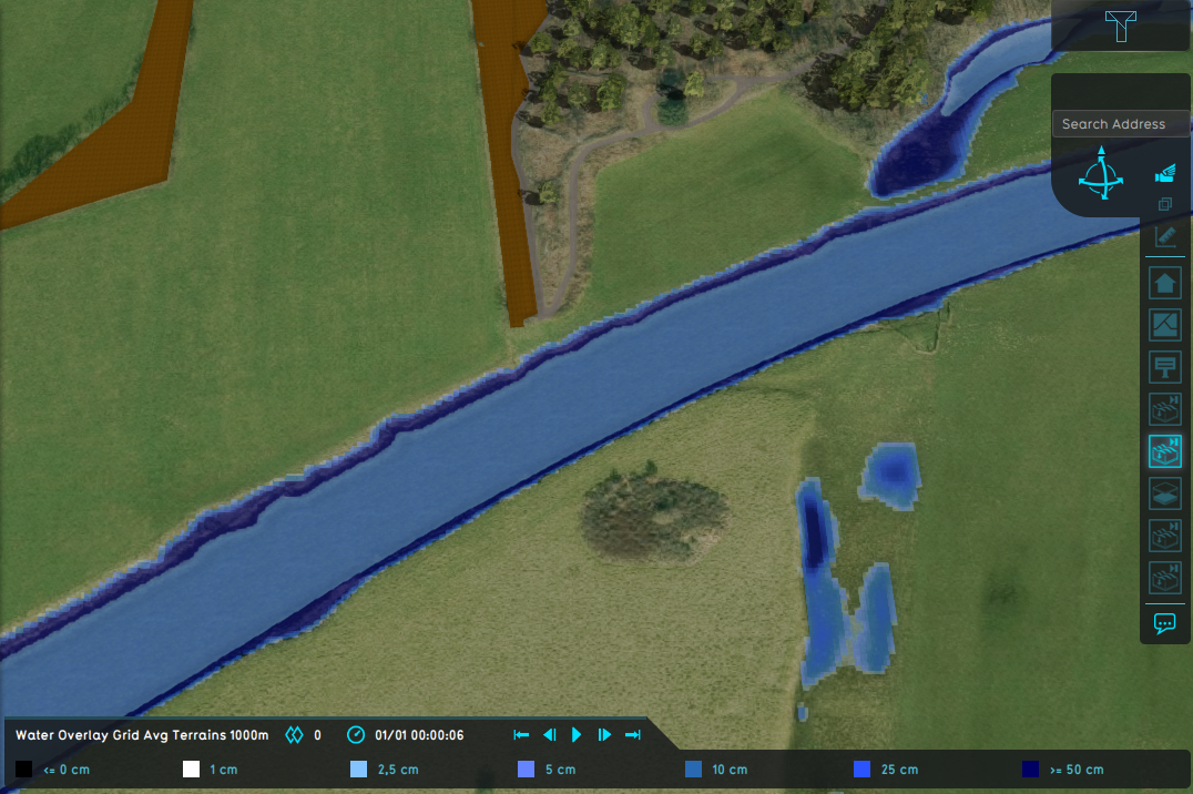
Water Overlay with set to Grid Averaging Terrains and an average terrain width of 1000m.
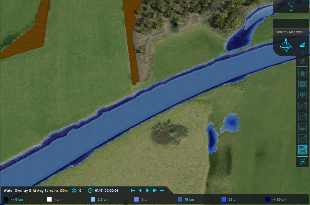
Water Overlay with set to Grid Averaging Terrains and an average shore width of 100m.
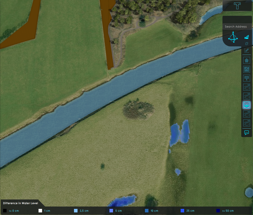
Difference in water level.


- Group
- Model attributes
- Allowed water increase m • Avg shore width m • Avg terrain width m • Avg terrain storage m • Breach measurement distance m • Bridge elevation • Culvert dem threshold m • Design flood elevation m • Extended reconstruction • Ground bottom distance m • Ground bottom pressure m • Ground water • Ground water depth m • Ground watertable with surface • Impact flood threshold m • Impact range m • Increased resolution • Infiltration factor s
- Limit area • Limit rain • Max infiltration m • Max water bottom m • Microrelief storage fraction • Min max elevation • Object entry correction • Prequel surface level relative • Rise rate distance m • Sewer overflow threshold • Shoreline • Show duration flood level m • Stabilizer angle • Start date ms • Surface water • Surface water evaporation factor • Timeframe times • Timeframes • Unsaturated fraction • Weir dam multiplier • Weir move interval s • Weir move range m • Weir move step m
- Related