How to create a Geo Plugin for DXF files
A Geo Plugin can be used to automatically match features to functions when importing a DXF file.
How to create a Geo Plugin for DXF files:
- Open Geo Plugins by going to Tools → Geo Plugins
- Switch to the GeoLinks tab of the Geo Plugin detail panel.
- Add a new Geo Link.
- Switch to the "Matching Attributes" tab in the Bottom panel of the Editor.
- Click on the Add button below Attributes. A new attribute is added.
- Double click on the new attribute and rename it LAYER
- Next, click on the add button below Values. A new layer value has been added.
- Double click on the new value and rename it as desired. This will in effect be the name of the DXF layer in AutoCAD.
- Switch back to the "General" tab of the GeoLink.
- Give the name of the Geo Link in the Name field.
- Set the "Function" of the GeoLink to the desired Function to create.
- If applicable (e.g. for trees), set the "Geometry" setting to RADIUS_CENTERPOINT.
- Leave all other settings as default.
- Repeat the creation of a GeoLink and its configuration, for each type of Function which should be created.
-
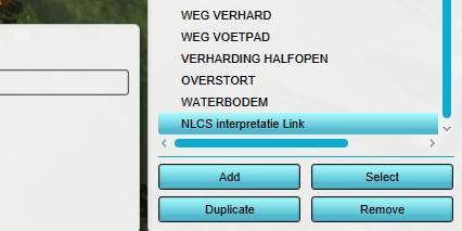 Add a new Geo Link to the Plugin
 -
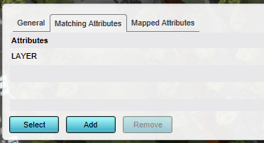 Add LAYER attribute
 -
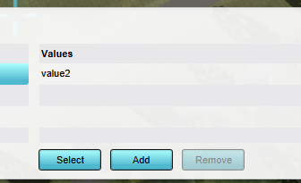 Give value of attribute (In effect the AutoCAD layer name)
 -
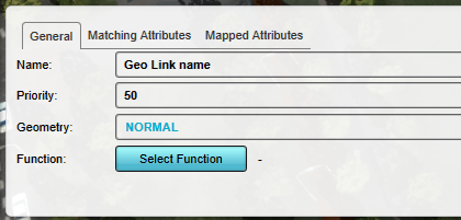 Give the new Geo Link a name


Notes
- A Geo Plugin created through this process can also be linked to a Project Source referring to a DXF on the GeoShare, so that data from that DXF is automatically included in new Projects. To set this up, select that Project Source as source for this Geo Plugin, and ensure the "Use for New Projects" option is checked.
- Due to how new Projects are generated, if a (Buildings) Geo Plugin is set to be usable during Project creation it does not allow setting Geo Links to road Functions. To create roads during Project generation, use a Roads Geo Plugin.
- A Geo Plugin created through this process can also be used to automatically define the mapping when the data originates from other data sources, such as GeoJSONs or WFSs.
- If a DXF layer contains features that should map to different Functions (e.g., various housing types), ensure they are distinguishable by color or block name. Add a second attribute mapping for COLOR or BLOCK_NAME to the Geo Link to assign functions based on these values.
How-to's
- How to import a DXF
- How to export a DXF reference file for a project
- How to import AutoCAD BLOCKS with attributes
- How to predefine the DXF geo-location in AutoCAD
- How to set the unit of measurement for a DXF
- How to create a Geo Plugin to import Buildings from a DXF
- How to deal with a long processing DXF import
See also
API Endpoints
- Api session event editor geolink add
- Api session event editor geolink set name
- Api session event editor geolink set function
- Api session event editor geolink set mapping
- Api session event editor geolink set matching
- Api session event editor geolink set geometry mode
- Api session event editor geoplugin add
- Api session event editor geoplugin add link
- Api session event editor geoplugin add new links
- Api session event editor geoplugin set source
- Api session event editor geoplugin set layer name
- Api session event editor geoplugin set name attribute