Flooding Overlay: Difference between revisions
Jump to navigation
Jump to search
No edit summary |
|||
| Line 1: | Line 1: | ||
==What is the flooding overlay?== | ==What is the flooding overlay?== | ||
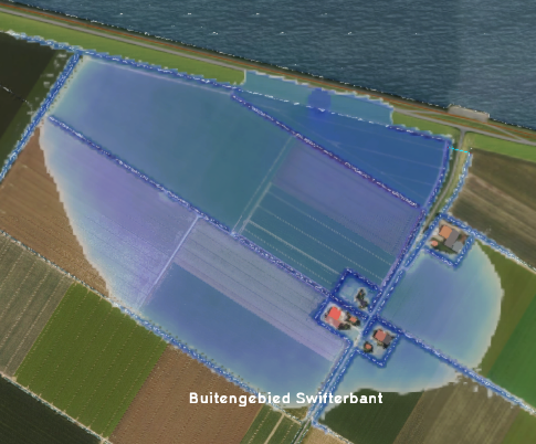
[[File:FloodingOverlay2.png|right|thumb|200px|Flooding overlay]] | [[File:FloodingOverlay2.png|right|thumb|200px|Flooding overlay]] | ||
The Flooding overlay uses the [[Water Module|water module]] in the Tygron Platform to visualize the movement of water over land in combination with a [[Breach|breach]] or other [[Inlet|inflow]] of water in the project [[Water area|water area(s)]]. | The Flooding overlay uses the [[Water Module|water module]] in the Tygron Platform to calculate and visualize the movement of water over land in combination with a [[Breach|breach]] or other [[Inlet|inflow]] of water in the project [[Water area|water area(s)]]. | ||
==Flooding overlay results== | ==Flooding overlay results== | ||
Revision as of 09:30, 9 April 2019
What is the flooding overlay?
The Flooding overlay uses the water module in the Tygron Platform to calculate and visualize the movement of water over land in combination with a breach or other inflow of water in the project water area(s).
Flooding overlay results
Flooding overlay results
List of Result Types
