Water Connection Generator
The Water Connection Generator enables users to generate (and remove) underground buildings using a set of parameters. This generator can be used for example when creating a project with the Water Overlay, but a dataset with all culverts is not available. With the water connection generater, the culverts can be generated. The parameters are explained below under Advanced Options. The water connection generator panel can be found in the Current Situation tab:

To get started with the Water Connection Generator, see the Demo Create Culverts project which is available in your domain.
Options

There are a few basic options which form the foundation of using the Water Connection Generator. These options are displayed at the top of the Water Connection Generator's window.
Function
What Function should be applied to the buildings generated by the Water Connection Generator. Due to the nature of water connections, only Functions of the underground Function Category can be selected.
Applied on
Where the new buildings should be generated. The following settings are allowed:
- Entire map: Generate buildings across the entire map.
- Nearby area: Generate buildings only in the vicinity of the Camera's current location. This is everything currently visible by the camera, or within 250m of what is currently visible by the camera.
- Specific neighborhood: Generate buildings only in a specific Neighborhood.
Advanced Options

There are a variety of advanced options available which allow fine-tuning the exact circumstances under which buildings are or aren't generated. The provided defaults are meant to allow using the Water Connection Generator and getting reasonable result with minimal effort, but by further refining the generator's configuration its possible to improve the results for a given location and use-case.
Minimum and maximum length
Both the minimum and maximum length in meters can be provided to set the length of the created water connections and to limit the amount of created connections. The length is measured as the closest points between two water bodies.
Large road threshold
A road is considered large (and therefore impassable by a water connection) when the road's size is larger than the set threshold value. This parameter can be used to prevent water connections crossing large roads. The large road threshold is provided as a surface size in m2. The surface size of each road polygon is then checked against the threshold value.
Large road straight

The large road straight parameter is used to measure if waterways are perpendicular to each other. It is measured by extending the placed water connection by x meters and if it is still in a waterway or body, then it is perpendicular and accepted. For parallel waterways, this check will not create a water connection when the defined x is sufficiently large.
Maximum height difference
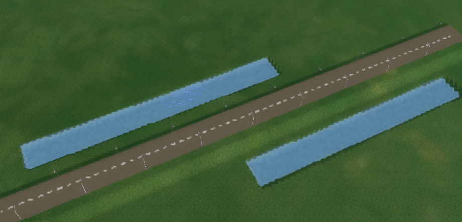
Two waterways with a levee inbetween. A stricter max height difference can prevent the creation of an unrealistic water connection. 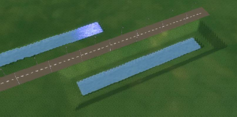
Two waterways, of which one is situated 5 meters lower than the other, where there typically would be no water connection.


The maximum height difference in meters that is allowed for the water connection te be generated. The height difference is measured on the surface where the water connection would be. This parameter can therefore be used to detect levees on the surface and prevent water connections through them. Additionally, this same parameter can be used to prevent connections being created for water ways that have very different water levels.
Width
The generated water building will have its width set to this value when generated. The width is provided in meters. For culverts, the width will be the culvert diameter.
Ignore upstream (beta)
Sometimes multiple water connections can be created between two waterways. This can be acceptable when both are situated at the same datum height, but when situated at a slope, it is more desirable to ignore the higher one. See the following images for a situation where this option can be useful. By Default this option is ignored by setting the value >= 100.
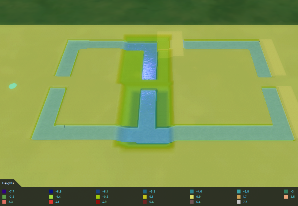
Upstream situation, the lowest waterway can connect to each of the waterways north of it. The greener parts are 2 meters lower than the yellow parts. 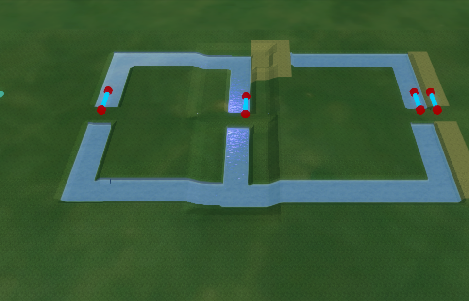
By default, it connects to both waterways. The north-eastern waterway also creates a connection, but at a location slightly to the left. 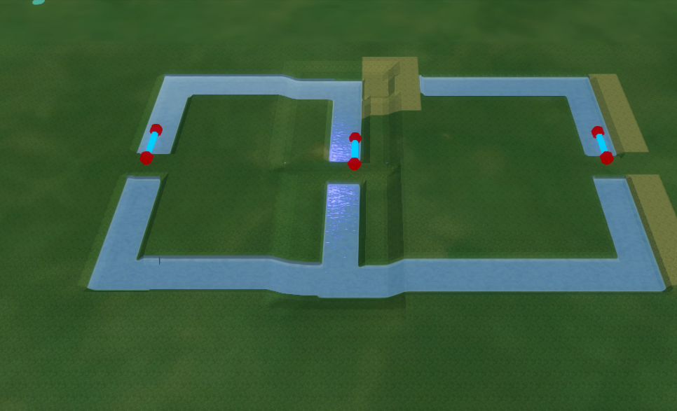
By configuring the ignore upstream parameter to 1 meter, the upper connection for the southern waterway is not created, leading to only three culverts. The north eastern waterway still makes a connection, because in its situation a culvert is still desirable.


Include water bodies
When selected, both waterways and water bodies are taken into account as water terrains where water connections to and from are generated. When not selected, only waterways are taken into account.
Reset and remove

- The Reset to defaults action reverts the values of the advanced options back to the default settings.
- The Remove generated action removes all generated buildings of the selected function. Note that this also removes not generated buildings of this function. For example buildings which were imported or manually drawn.
Notes
- To get started with the Water Connection Generator, see the Demo Create Culverts project which is available in your domain.
How-to's
- How to use the Water Connection Generator to generate Buildings
- How to use the Water Connection Generator with advanced options to generate Buildings
- How to remove Buildings generated by the Water Connection Generator
See also
- Culvert (Water Overlay)
- Hydraulic structures (Water Overlay)
- For more information on the use of the water connection generator, see this video (Dutch only):
