Demo Parametric Project
The Demo Parametric project is available for all users and can be found in the main menu under Edit projects. This project does not count towards your license.
This project is intended for urban planners and zoning policy makers.
This project showcases how parametric designs can be used for rapid planning and prototyping.
The demo is a project in which a location in The Netherlands has room for new urban development, and a number of Parametric Designs are prepared to allow for quickly designing entirely new urban areas. The project was originally created for a specific organization to test how the use of Parametric Design would affect their Indicators, but is publicly available for all users to experiment with.
Exploring the project
To begin exploring the project, take the following steps:
- Click anywhere in the 3D world, and use the arrow keys on your keyboard to move around in the world. You can also drag the camera around by right-clicking (and holding the right mouse button down) in the 3D world and dragging the world around. Use the scroll wheel to zoom in- and out.
- At the top of the the interface you can see the top bar. Click on any of the Indicators to open an indicator panel with information on how a score for the Project is determined.
- The Green Indicator shows whether there is a sufficient amount of publically available green space in a given area. Depending on the aspects of that location, the ratio should be anywhere from 10% to 60% to receive a minimum allowable score of 6. The default score (and maximum score) is 10.
Point of interest
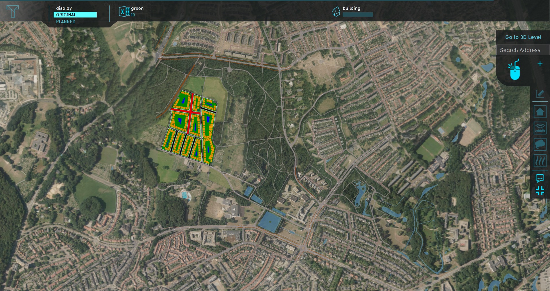
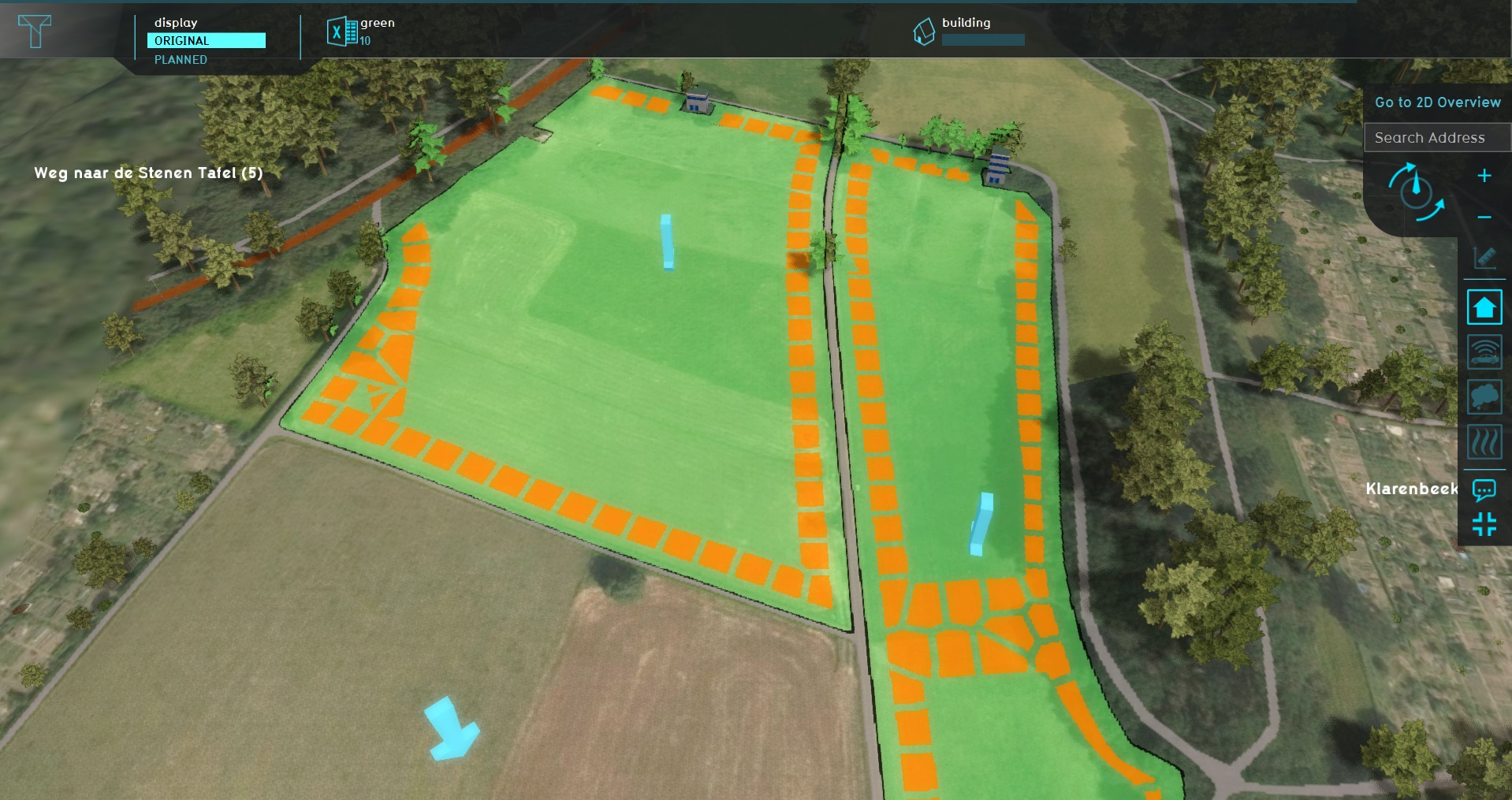
The most important location in the 3D world is on the western side of the project area. This is an empty location in which Parametric Design can be employed to create an additional residential area. There are few areas defined, indicated by the arrows, which have specific requirements to compute the Green Indicator. Other than that, and the small coutry roads dividing the areas, it's just empty space to build on.
Actions
The project is focussed on experimenting with options for Parametric Designs. Note that some actions may result in the start of a testrun.
This means the editing tools will be temporarily disabled. When you are done experimenting with actions, you can stop the testrun by clicking the stop button in the ribbon. This will revert the session back to its base state, without the effects of the applied action(s).
Prepared Designs
Switch to the "Future design" tab, and then click on "Parametric". This will open the list of currently defined Parametric Designs in the left panel of the Editor.
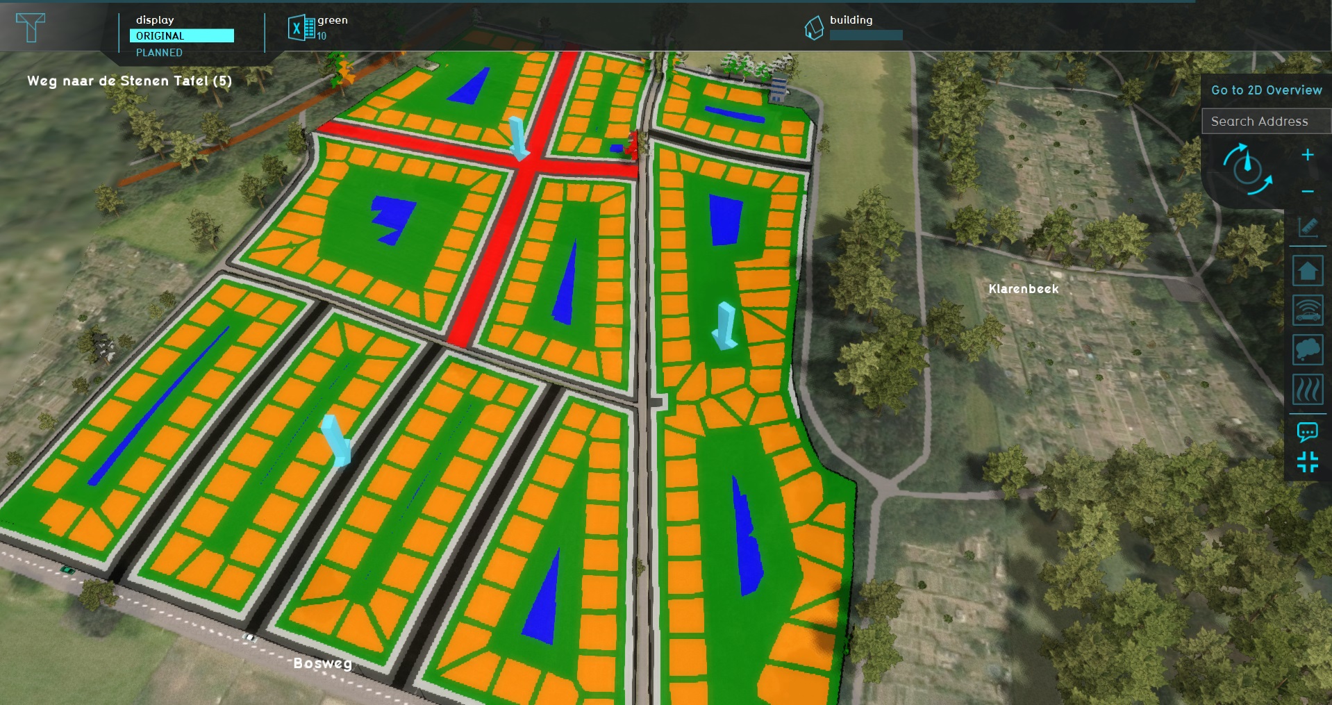
Select "Urban Residential Design v1" in the list of designs. You will see the right panel of the editor display details about this design, and you will see in the 3D world a colored representation of the planned design. Take note of the following:
- You will see the main structures are lined up along the pre-existing and the newly planned roads.
- You will see a number of bands along the roads, representing room for pavement and parking spaces.
- You will see in the center of the various blocks small ponds.
All of the features you see are automatically generated, based on parameters of the design (hence the name).
In the bottom panel, you will also see a pie chart and a number of statistics regarding the design as it currently stands. The statistics show how much space will be taken up by each feature. It additionally shows a percentage, indicating how much of the total area of the design that represents. The pie chart is a graphical representation of those percentages. Note that the sum of the percentages (and thus the pie chart) may not add up to 100%, indicating some of the design's space is left empty.
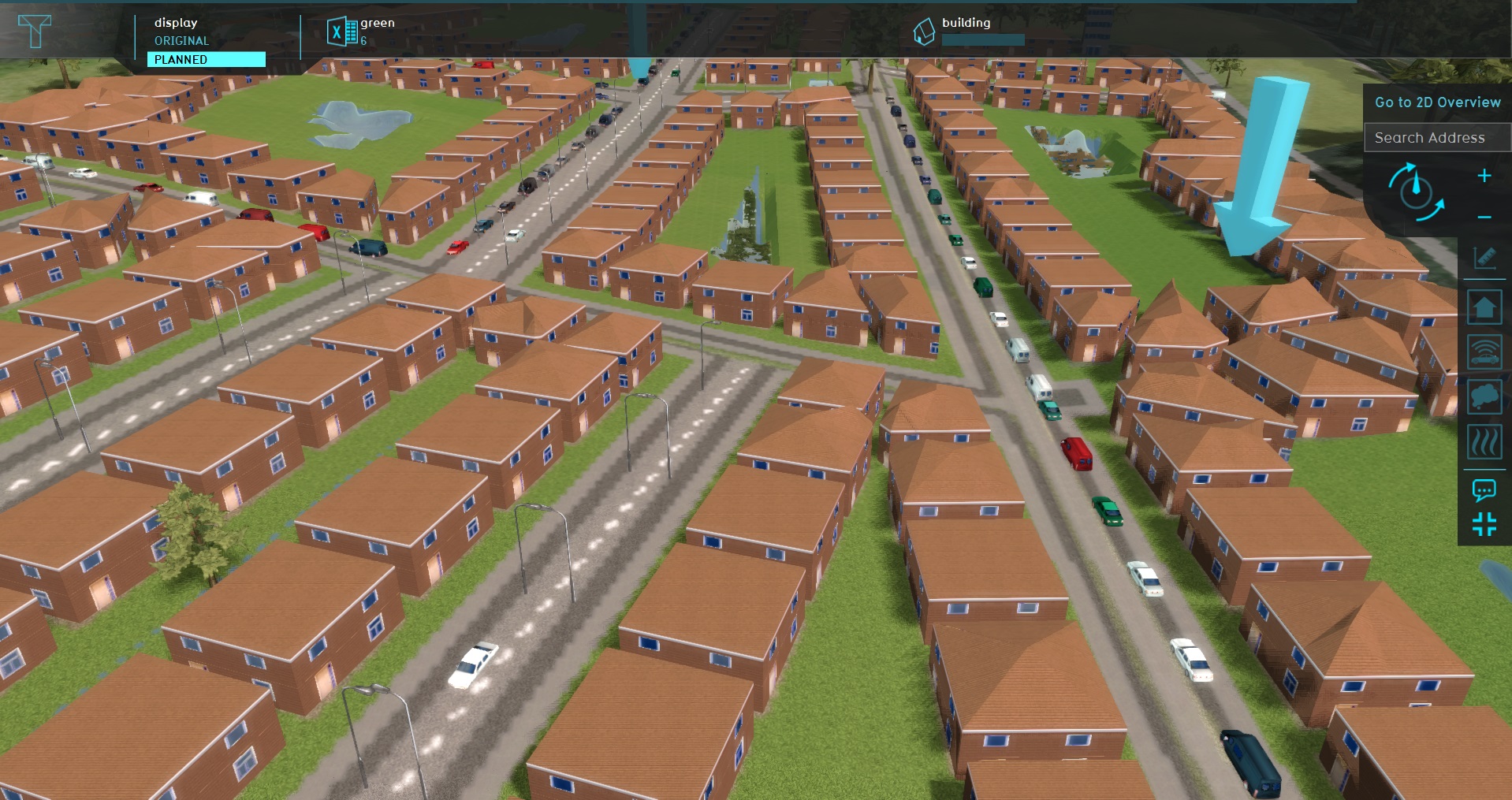
At the bottom of the right panel, click on "Apply Design". Note that a testrun will start; that's ok. You see a large amount of structures appearing in the 3D world, matching the pattern previously displayed by the colored representation.
Note that the Indicators in the top bar have changed as well. The average score for the Green Indicator has dropped from a 10 to a 6. And if you click on the Indicator to see the scores per section of the planned area, you will even see that the scores for some areas have dropped even below that.
At the bottom of the right panel of the Indicator, select "Revert Last Design". You will see the structures disappear from the 3D world. The plan is now undone.
Tweaking a Design
You can change the parameters of a design, so that the structure of the result better fits the needs of the surrounding use-case. In this case, to make the Green Indicator score better, the ratio of publically available green should be improved. More space should be unoccupied.
Ensure the "Urban Residential Area v1" design is (still) selected, and take note of the parameters displayed in the right panel. There are many of them, because there are also many elements part of the design.
Find the parameter for the "Road between distance". This parameters indicates the maximum amount of distance which may exist between two roads. If the distance would be greater than this amount, an additional road is added. This causes the blocks of houses to become smaller, as the total area is divided into more and more smaller sections, leaving less internal space to be open and green. Set this parameter to 80 meters.
Find the parameters "Main road distance". This parameter indicates the maximum distance a road may be to the main roads, pre-existing roads, or the edge of the design. If the distance becomes too great, a planned road is upgraded to a wider main road. Set this parameter to 100 meters.
Lastly, find the "Water percentage". This parameter indicates how much water should be added, starting from the center of each block of plots. Given that for the Green Indicator the amount of open land should be maximized, any amount of water would effectively be a waste. Set this parameter to 0%.
As these changes were made, the colored representation of the Parametric Design in the 3D world has changed along with it, determining a new layout based on the now changed parameters.
Click on "Apply Design" again, and new structures will appear in the 3D world. The road layout is subtly different, and no ponds have been created. The Green Indicator in the top bar now also shows an average score of 7, which is an obvious improvement over the previous design's score of 6. Click on it, and you will see that some areas still score below a 6, and thus are not up to scratch, but a step has been made in the right direction, compared to the original plan.
Creating a Design
Other than creating tweaking a pre-existing design, it is of course also possible to create a completely new Parametric Design. First, make sure the testrun is stopped. Ensure the list of Parametric Designs is opened in the left panel, then click on "Add" at the bottom of the left panel. This adds a new Parametric Design. Select it, and the right panel will display the properties of the new Parametric Design.
A new design initially offers fewer parameters to set. This is related to the amount of defined features which will be placed by the design, which starts as a very sparse list.
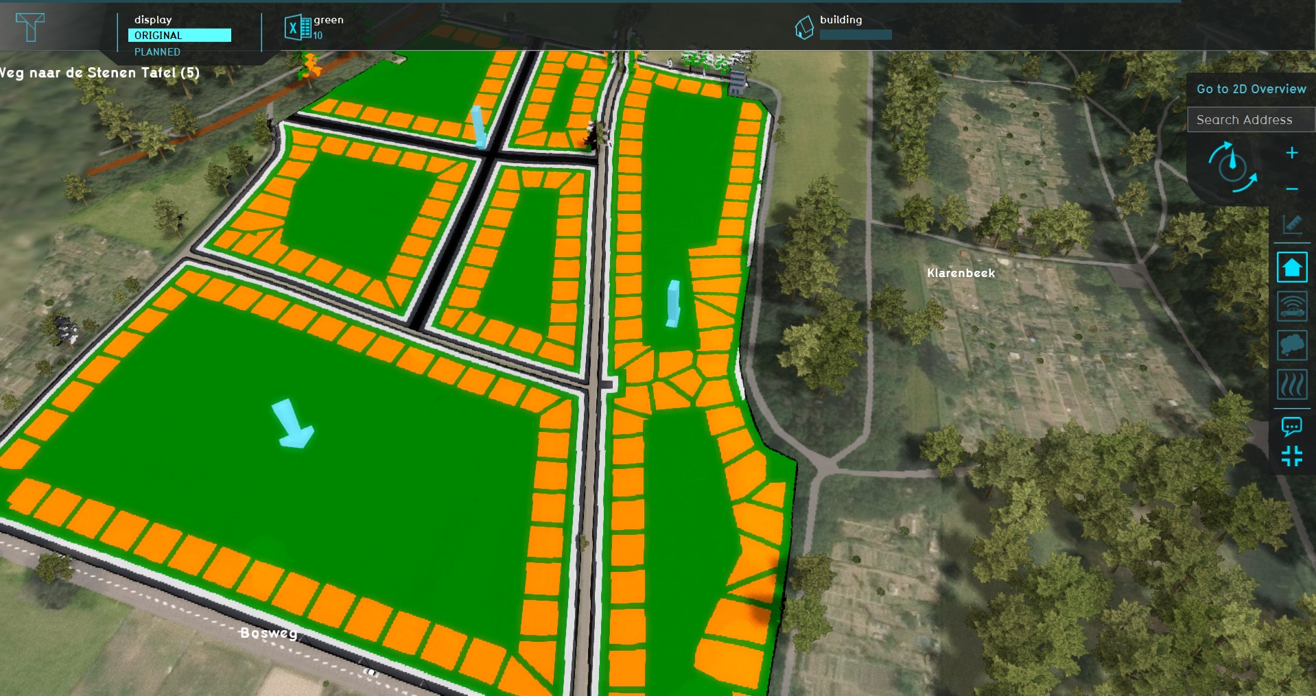
At the bottom of the right panel, click on "Draw Area". This will allow you to assign a location to the design. Use the brush to draw where the design should be applied to. Select the polygon of the Northern Plot, and of the Elongated Area on the east side of the relevant area. (This is easiest to do with either the "polygon pick" selection mode or the "blueprint" selection mode. You can also use a different selection type if you find another one easier. However, ensure that the resulting selection is attached to or overlaps with an existing road.) Click on "Apply selection" to save the selection as the [[Parametric Design]'s location.
Now, the Parametric Design's representation in the 3D world looks a lot simpeler than the pre-existing designs. This is again due to the fact that this design currently has fewer features defined.
At the top of the right panel, switch to the "Functions" tab. This shows the list of Functions defined for the various features a Parametric Design is capable of placing. By default, only a Function for the plot is defined. At a minimum for a realistic design, some form of roads should be defined as well.
Find the "Road" entry, and click on "No Value", to open the Function selection window. Of the category "Roads", select the "Road" Function. The representation of the Parametric Design in the 3D world will immediately include the added roads. Switch back to the "Design" tab, and you will also see a few additional parameters are available, specifically those related to roads.
Take note of the details displayed in the bottom panel. Set the "Road between distance" to 60 meters. It shows that just about 40% of the space is taken up by various features. Knowing that the areas where the design is drawn needs at least 60% of publicly available green, it would cut it very close.
Set the "Road between distance" parameter to 60 meters. The resulting design, as shown in the 3D world will be recalculated, and the statistics in the bottom panel will be updated as well. About 10% less of the space will now be taken up by placed features.
Apply the design, and the Constructions will appear in the 3D world. A lot of space will still appear unused, so this design is much more likely to score better on the Green Indicator than the previous design. Open the Green Indicator by clicking on it in the top bar, and notice that the scores are now well above a 6, making these plans acceptable in terms of green space.
