* This calculation performs an estimation of wall locations and may miss some areas. Therefore, it should not be taken as an absolute value, but can be used as a valid estimation in other calculations, such as the percentage of walls which also overlaps with specific [[Sight Distance Overlay|sight-lines]].
* This calculation performs an estimation of wall locations and may miss some areas. Therefore, it should not be taken as an absolute value, but can be used as a valid estimation in other calculations, such as the percentage of walls which also overlaps with specific [[Sight Distance Overlay|sight-lines]].
* The formula of the [[Combo Overlay]] checks whether the localized average [[DSM]] exceeds the absolute height by at least 1 meter, which generally means that the height of a wall should be at least 2 meters high. By changing the "1" into a lower or higher number, the approximation can be made more or less sensitive respectively.
* The formula of the [[Combo Overlay]] checks two conditions: (1) the smoothed [[DSM]] exceeds the [[DTM]] by at least 1 meter, and (2) the smoothed [[DSM]] exceeds the local raw [[DSM]] by at least 1 meter. Both must be true for a cell to be classified as a wall. By changing the "1" into a lower or higher number, the approximation can be made more or less sensitive respectively.
|api=
|api=
* [[Api session event editor overlay add]]
* [[Api session event editor overlay add]]
Latest revision as of 12:30, 13 October 2026
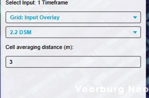
To identify structure walls for certain calculations, specific localized checks on elevation models are required. By analyzing the behavior and local changes in these models, a spatial calculation can be created to locate these walls.
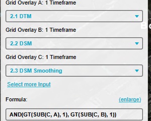
Add a Combo Overlay to the Project with the following configuration: Name: Walls Input A: DTM Overlay Input B:DSM Overlay Input C:"DSM Smoothing" Overlay Formula: AND(GT(SUB(C, A), 1), GT(SUB(C, B), 1))
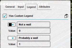
Modify the legend of the Combo Overlay to have only the following values: Value 0: No wall Value 1: Wall
Notes
This calculation performs an estimation of wall locations and may miss some areas. Therefore, it should not be taken as an absolute value, but can be used as a valid estimation in other calculations, such as the percentage of walls which also overlaps with specific sight-lines.
The formula of the Combo Overlay checks two conditions: (1) the smoothed DSM exceeds the DTM by at least 1 meter, and (2) the smoothed DSM exceeds the local raw DSM by at least 1 meter. Both must be true for a cell to be classified as a wall. By changing the "1" into a lower or higher number, the approximation can be made more or less sensitive respectively.