How to upload and use a groundwater GeoTIFF (Water Overlay)
(Redirected from How to upload and use a groundwater GeoTiff (Water Overlay))
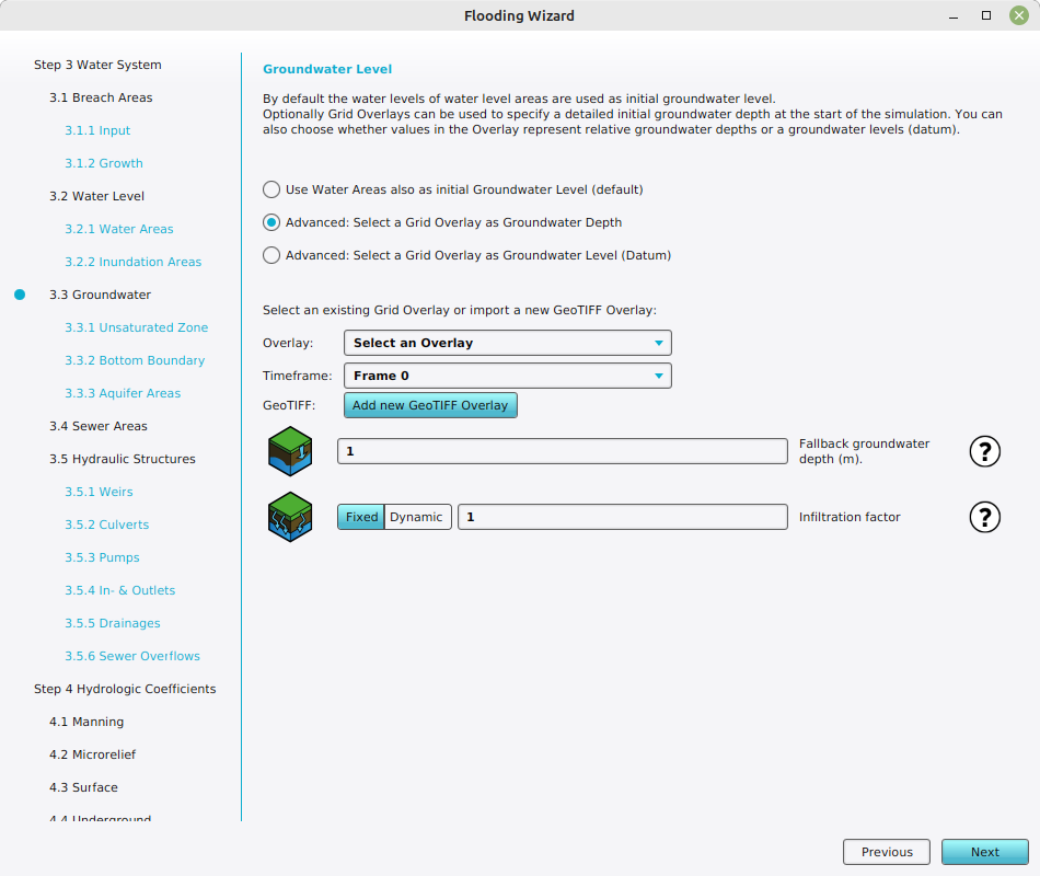
For a Water Overlay, the watertable can be defined by a groundwater prequel. GeoTIFF Overlays can be used as a prequel for either the groundwater level relative to the surface (i.e. the depth) or relative to datum (i.e. the height).
Editor → Current Situation (Ribbon tab) → Overlays (Ribbon bar) → The Water Overlay (Left panel) → Configuration Wizard (Right panel)
How to add your own GeoTIFF with groundwater data to the Water Overlay:
- Prepare a GeoTIFF file with the desired watertable depths.
- Open the configuration wizard of the Water Overlay.
- Continue to the step concerning ground water.
- If your GeoTIFF features groundwater depths, opt for "Select a Grid Overlay as Groundwater Depth".
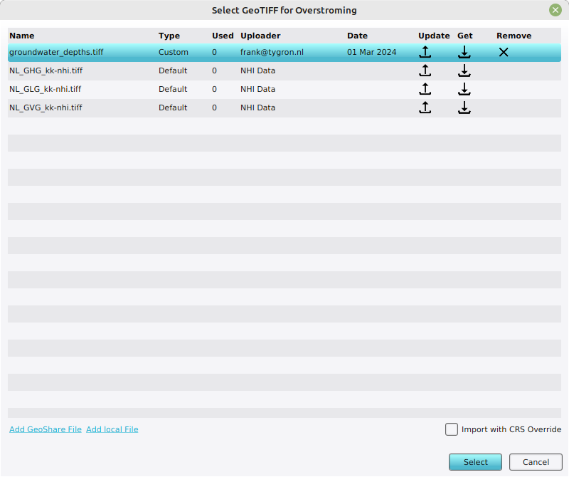
If your GeoTIFF features groundwater heights relative to datum, opt for "Select a Grid Overlay as Groundwater Level (Datum)". - Click on "Add new GeoTIFF Overlay". The "GeoTIFF selection" window will open.
- Select "Add local file", locate your file and select it. This will automatically upload the GeoTIFF to your project.
- Now find and click on the added geotiff in the "GeoTIFF selection" window, and click on "Select" to confirm.
- Close the wizard.
-
 Select one of the advanced steps to show the option to Add new GeoTIFF Overlay
 -
 Add local file and select the GeoTIFF once uploaded to your project.

