How to access your Project WFS in QGIS
(Redirected from How to access your project's WFS in QGIS)
The Tygron Platform allows you to access geographical features through a WFS endpoint, making the data available to view and edit via other GIS application.
How to access the WFS of your project in QGIS:
- Select the export option of the geo data source you wish to access.
- For the export option "Web Feature Service", select "Copy URL". This will store the URL on your clipboard.
- Open QGIS.
- Add a WFS Layer: Layer -> Add Layer -> Add WFS Layer ...
- Click new to add a new server connection.
- As URL for the server connection, paste the URL copied to the clipboard earlier.
- Click OK to save the connection.
- Connect to the newly created connection.
- Select the desired WFS layer.
- Select "Add" to add the features as a new layer to your QGIS project.
-
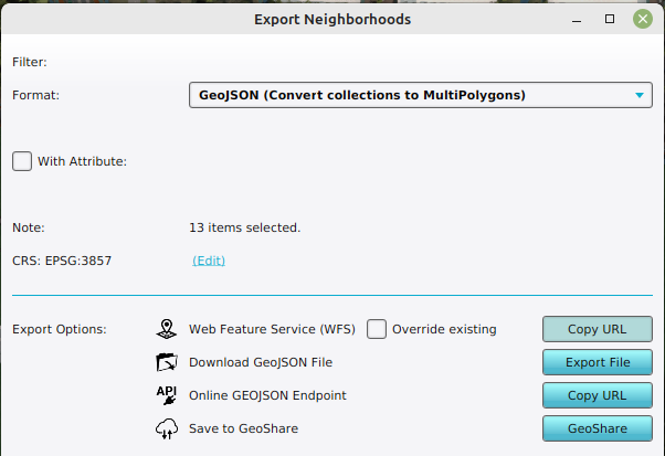 Obtaining the WFS link of Neighborhoods
 -
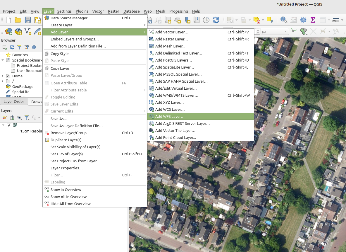 Add WFS Layer in QGIS
 -
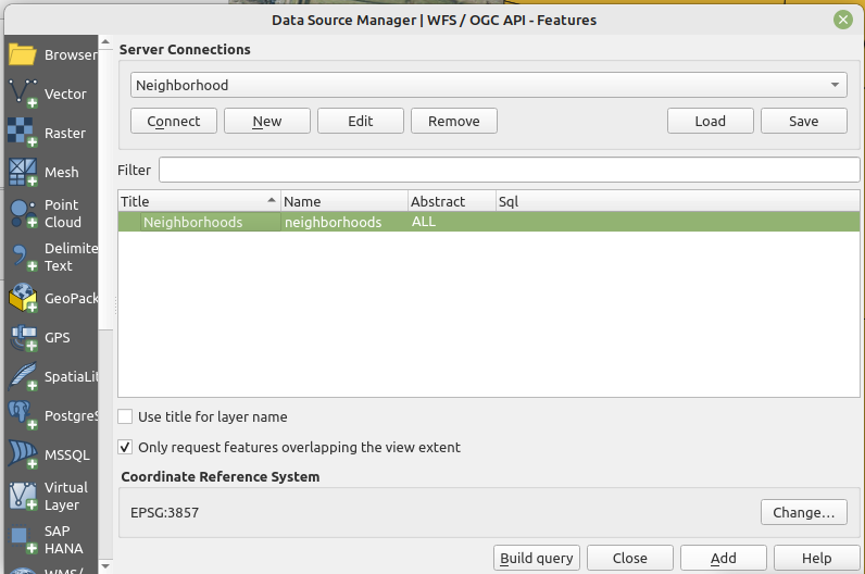 Select and add the WFS Layer


Notes
- The instructions listed here specify QGIS, but other GIS applications support the WFS standard as well.
- The WFS is currently only available when a project is active in the editor.
- The WFS url includes an authentication token which ties the validity of the url to a specific session. If the editing session is closed and reopen at a later time, the url will need to be renewed.
How-to's
- How to edit your project data via WFS
- How to edit a Measure with QGIS
- How to modify your project's WFS url to allow transactions to overwrite conflicting data