Sky view result type (Heat Overlay): Difference between revisions
Jump to navigation
Jump to search
No edit summary |
No edit summary |
||
| (One intermediate revision by one other user not shown) | |||
| Line 1: | Line 1: | ||
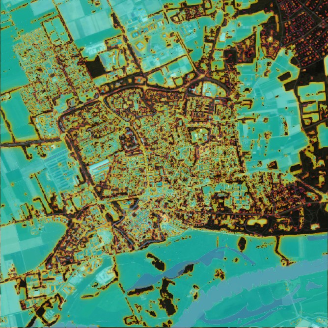
[[File:Wageningen SkyView-01.jpg|350px|thumb|right|Sky View result type overlay (Wageningen)]] | [[File:Wageningen SkyView-01.jpg|350px|thumb|right|Sky View result type overlay (Wageningen)]] | ||
{{result types|<onlyinclude> | |||
{{result types|type=row|overlay=Heat | |||
|name=SKY_VIEW | |||
|icon=Overlay icon heat sky view.png | |||
|unit=fraction | |||
|mode=[[Result types (Heat Overlay)#Start type|Start]] | |||
|description=The calculated sky view factor. | |||
}}</onlyinclude>}} | |||
The sky view factor is a fraction which describes the amount of the sky which is visible from any given location. Constructions and other surface elevations can block parts of the sky, lowering the fraction. The visible section of the sky is projected onto the the 2D surface before computing the fraction. | The sky view factor is a fraction which describes the amount of the sky which is visible from any given location. Constructions and other surface elevations can block parts of the sky, lowering the fraction. The visible section of the sky is projected onto the the 2D surface before computing the fraction. | ||
{{article end | |||
|notes= | |||
|seealso= | |||
* [[Sky view factor calculation model (Heat Overlay)]] | |||
|references= | |||
{{ | }} | ||
{{HeatOverlay result type nav}} | |||
Latest revision as of 12:00, 13 September 2021
| Icon | Result type | Unit | Mode | Description |
|---|---|---|---|---|
| |
SKY_VIEW | fraction | Start | The calculated sky view factor. |
The sky view factor is a fraction which describes the amount of the sky which is visible from any given location. Constructions and other surface elevations can block parts of the sky, lowering the fraction. The visible section of the sky is projected onto the the 2D surface before computing the fraction.


