Parametric Design
Concept
A parametric design consist of the following seven elements which make up the spatial plan:
- Roads
- Water
- Parking
- Side walk
- Building
- Garden
- Public Green
For each of the elements a function can be chosen. Other parameters such as the width of the roads and the number of floors for the building can be adjusted. To generate the design, the amount in percentages of each function (with the exception of the side walk function) can be adjusted with a slider.
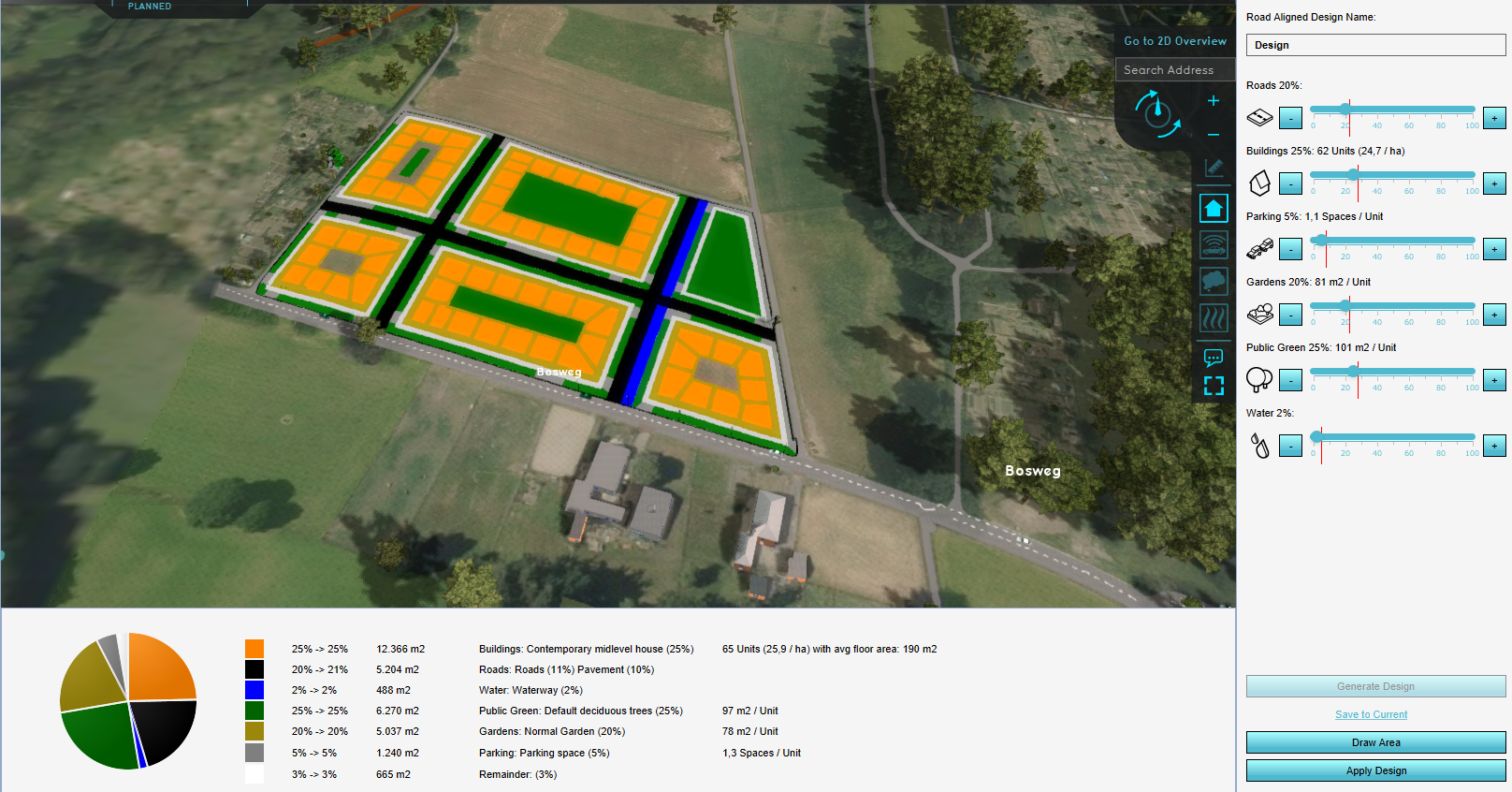
The general strategy is to choose an area and a design type (see below). Then set with the sliders the percentage per function you would like to see in the design. After the design is generated, notice in the pie chart in the bottom panel the actual percentage of each function that is calculated by the algorithm behind the parametric design generation. When you are happy with the generated design, the plan can either be saved to the Current Situation or constructed in Future Design.
Parameters
There are 4 tabs with parameters that can be adjusted for generating a parametric design. Below the parameters per tab described.
Design
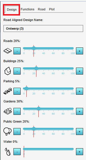
For the following functions the amount in percentages can be set with a slider.
- Roads
- Buildings
- Parking
- Gardens
- Public green
- Water
The red vertical lines in the sliders indicate the maximum amount of each function you can choose, based on the other sliders and their set values.
Functions
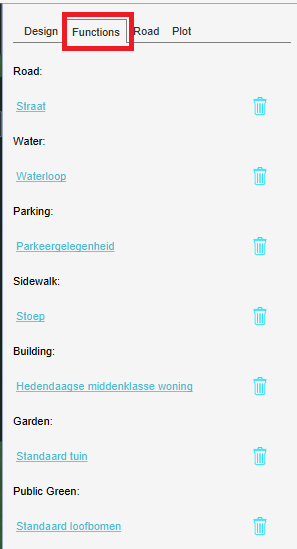
For the following elements, the function can be chosen:
- Roads
- Buildings
- Parking
- Sidewalk
- Gardens
- Public green
- Water
Road
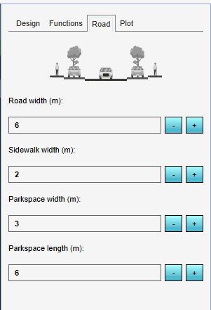
- Road width (m): The width of the created roads in meters.
- Sidewalk width (m): The width of the side walk placed alongside the roads in meters.
- Parking width (m): The width of one parking space in meters.
- Parkspace length (m): The length of one parking space in meters.
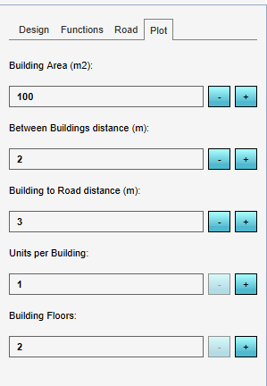
Plot
- Building area (m2): the area size of the Plot intended for the building.
- Between Buildings distance (m): The distance between the buildings in meters.
- Building to Road distance (m): the distance between the building and road in meters.
- Units per Building: The created Buildings in the design will have this amount of units.
- Building floors: The created Buildings in the design will have this amount of floors. Based on the Min and Max floor setting of the Building function, an amount of floors can be chosen.
- Height (only for spaced design types): the height of the Buildings.
Pie chart
The pie chart provides information over the generated design. Per element in the design, the following information is given:
- The percentages that was set with the sliders in the Design tab. Behind the arrow, the percentage that is actually in the design is shown.
- The area size in m2
- The element and function as chosen in the Functions tab. The actual percentages are again shown in parentheses.
Notes
- The percentages shown in red indicate that the set percentages with the sliders could not be met and are therefore changed to the best fitting percentage per function for this area with these parameters.
- In the pie chart, undeveloped land is listed as Remainder.
- For Buildings, the amount of units, the units per hectare and the average floor area of the buildings is provided.
- For Public Green and Gardens, the area size per unit is given.
- For Parking, the amount of parking spaces per unit is given. The size of a parking space can be set with the parameters in the Road tab.
Design types
There are two types of design lay-outs available. The design type dictates the algorithm used to place the defined elements.
Road aligned design
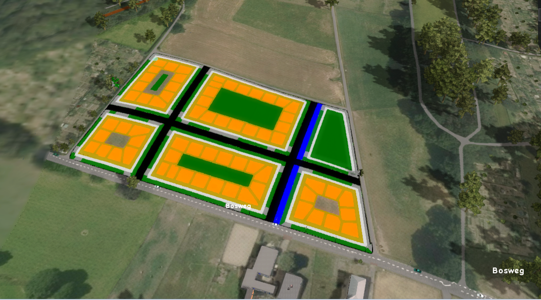
In and around the selected area, roads are sought. The new roads in the design are connected to the existing roads. The roads divide the space in blocks. Waterways, parking spaces and the sidewalk are placed alongside the roads. Each rectangle consists of buildings, gardens and public green. Public green can also be placed alongside a road. This design type can be best used for creating spatial plans which consists of buildings.
Spaced design
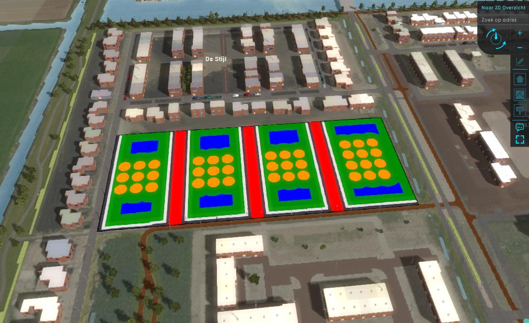
In the defined area for the design, a grid of circular selections are created. This design type can be best used for creating spatial plans which consist of trees or for example wind turbines.
Notes
- Save to current: a test run is not started. Instead it is applied to the Current Situation. This method is not easily reversed.
- A parametric design can only be generated on an empty Terrain. Remove the existing Constructions first or choose an undeveloped area for your design.
