Cornell Showcase (NYC)

The Cornell Masters in Urban Planning Studio focused on policy approaches that would allow the New York City Housing Authority (NYCHA) to raise revenues in order to repair buildings and address their residents’ needs.
Cornell students Kushan and Nico examined an innovative policy approach that would permit NYCHA to transfer the development rights to property within their ownership to adjacent areas. This approach has been used to support new parks but has never been used as a way of supporting affordable housing. They then created an innovative project in the Tygron Platform that tested the potential gains and acceptability of building up developing different surrounding areas. Several architects, planners and city officials who reviewed their work were impressed by their ability to show the key trade-offs involved through the Tygron Platform. They have made their study open to the public. It is a great example of how the Tygron Platform can be used in major studies.
January 7th, 2015
Hi all,

We are two students studying City & Regional Planning at Cornell University in Ithaca, NY. As part of a semester-long urban design studio in NYC, we had the opportunity to engage with Tygron's tool for scenario planning. We explored various uses for the software on the topic of affordable housing and livability, looking at Tygron's potential for sparking key conversations in decision-making negotiations.

We then chose to see how we could use the software in a different way: moving away from its traditional purpose (which is to explore trade-off relationships, inform decision-making negotiations, and spark conversations over ownership and zoning, amongst other possibilities), we chose ‘simplify’ its use by exploiting its real-time modelling abilities on a specific topic: the impact of transferring development rights on the urban fabric.

In the following posts and over the next couple of days, we will showcase and summarize our study, and detail our use of the Tygron software.

Nicolas / Kushan
MRP
Preliminary Research
Premise
- In NYC, shortage of housing (market & affordable). - Since 2005, median rent increased by 11%, while median household income has slightly decreased. As a result, 47% of low-income renters heavily rent burdened. - Mayor De Blasio’s housing policies focus on the construction of new affordable units. - Our focus is on Baruch Houses, an affordable housing project in the lower east side, from which we want to potentially transfer unused development rights.
Challenge
- Challenge for developers: building market rate (and/or affordable housing) in a city where building sites are rare and costly. Little vacant land overall, and high cost of demolition – a limited number of smaller, older buildings that can be profitably demolished.
- Challenge for NYCHA: increasing profits to reinvest into capital projects and maintenance.
- Challenge for the city: historic preservation, maintaining urban fabric and neighborhood desirability. In addition, creating areas which are consistent in size and scale to define markets for the transfer of development rights.
Transfer of development rights (TDR)
- Baruch campus has 1.2 million sq. ft. of underbuilt land. - However, previous studies of the site lead us to estimate that 400,000 sq ft. of land will be developed via various infill interventions. - We make the assumption that the remaining 800,000 sq ft. can be used for TDR from NYCHA to LES.
Qualifying Sites
When identifying sites for TDR, different restrictions can be applied, for instance:
- Location:
o For Hudson River Park, TDR requirement to happen one block east of the park.
o Historic districts
o Special purpose districts: i.e. Hudson Yards, South Street Seaport
- Age of buildings (i.e. only consider buildings built prior to 1970). i.e. East Midtown
- Vacancy rates
- Government Ownership, landmarks
- Site Size: in the Theater District, sites had to be >25000 sq ft to be considered qualifying.
In our example, we identify potential sites as being:
- 50% or more under built (0-50% FAR)
- Location: along main corridors of activity (used commercial overlay + nature of the
street)
- Site size: over 5000 sq ft.
The recent zoning change of 2008 that increased maximum FAR in certain areas of LES partially
explains a higher proportion of under built sites.
Introduction to the project

The definition of Transferring Development Rights (TDR)
A transfer of development rights (TDR) allows for the transfer of unused development rights from one zoning lot to another in limited circumstances, usually to promote the preservation of historic buildings, open space or unique cultural resources. For such purposes, a TDR may be permitted where the transfer could not be accomplished through a zoning lot merger. In the case of a landmark building, for example, a transfer may be made by CPC special permit from the zoning lot containing the designated landmark to an adjacent zoning lot or one that is directly across a street or, for a corner lot, another corner lot on the same intersection.
Source: NYC Department of City Planning http://www.nyc.gov/html/dcp/html/zone/glossary.shtml
DESIGN
Based on our previous research on the issue of TDR in the Lower East Side, we model LES + NYCHA campuses, taking into account the various zoning restrictions.
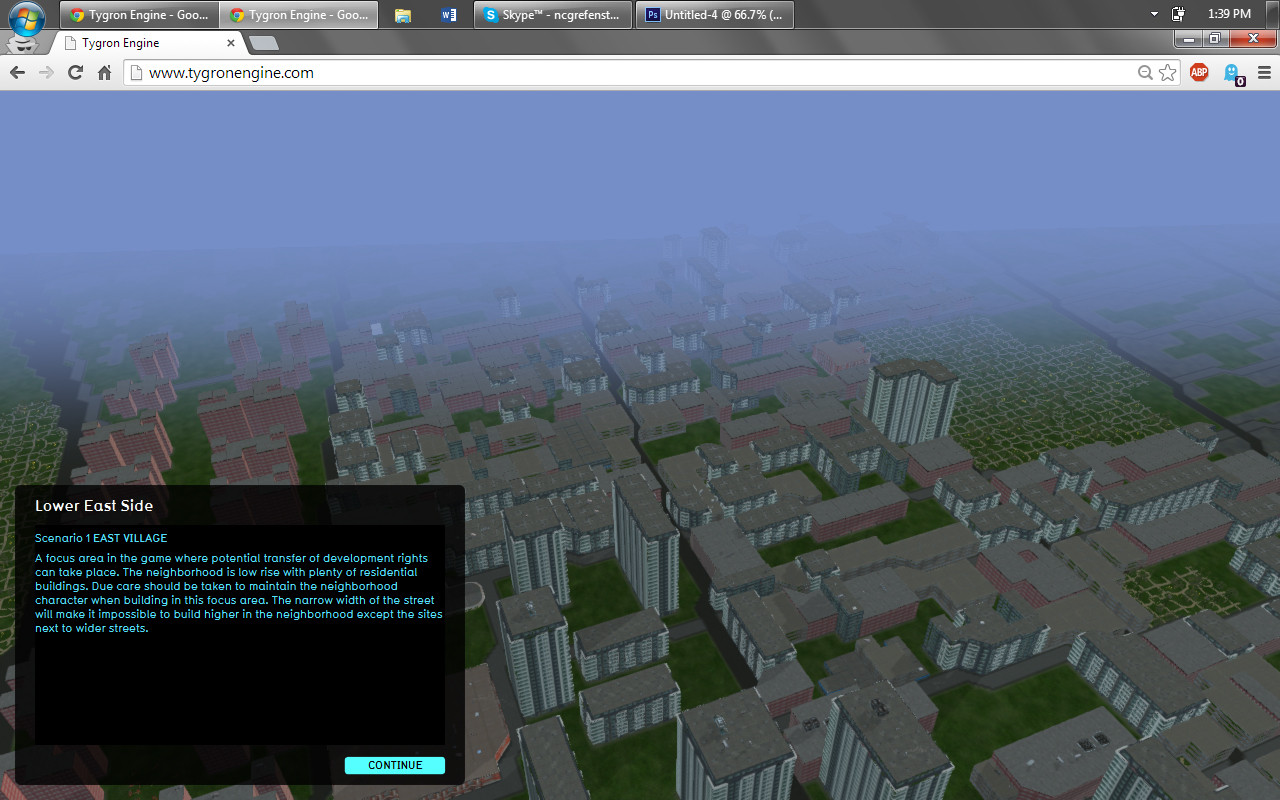
Introduction
The project session you are about to participate in explores the impact of the Transfer of Development Rights on the urban fabric. Tygron has been modified from its original use as a more holistic decision-making and negotiation tool to fit this purpose.
Please take a minute to read the context and session flow below.
New York City has an acute shortage of affordable housing. The mayor of NYC has promised to preserve and build 2500 affordable units in the city. In the larger context of the city, the Lower East Side (LES) neighborhood provides an interesting potential that can absorb a large chunk of the city's housing needs - affordable as well as market rate.
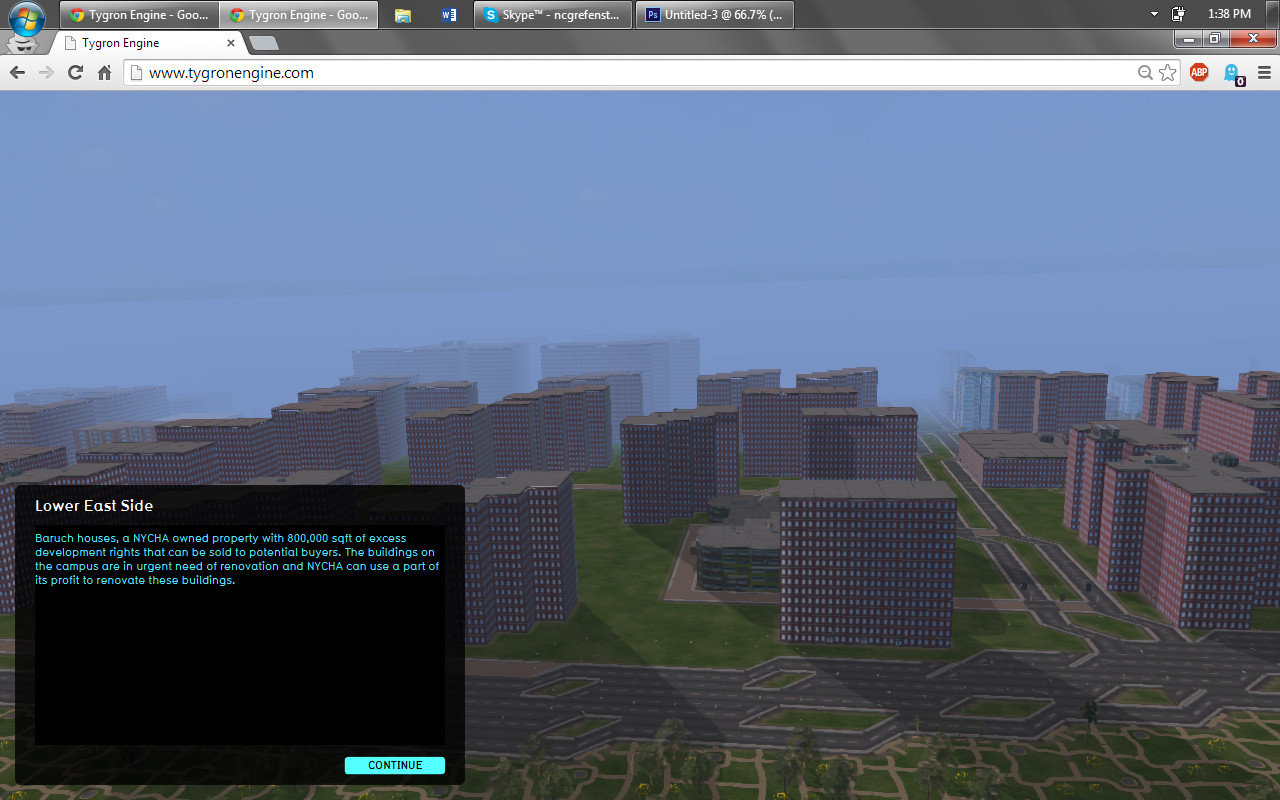
LES has many under built sites (Built FAR < 50% Zoning FAR) which can potentially be densified to accommodate for new affordable as well as market housing. NYCHA (New York City Housing Authority) owns over 3 billion sq ft of land within the LES, on several housing projects along the waterfront. Almost all the NYCHA-owned sites are underbuilt, meaning they have additional building rights that can be transferred or sold through TDR (Transfer of Development Rights). In addition, NYCHA's current financial problem prohibits it from restoring their existing housing stock or build new affordable units - they would highly benefit from the profit generated from TDR.
In addition to the above mentioned premise, the project focuses on the sell of Baruch Houses' underused development rights: Baruch Houses is an affordable housing complex within the LES that has about 1.2 million air rights that can be sold to potential developers. Based on previous modelling exercises, an assumption made is that NYCHA would be willing to sell about 800,000 sqft of these development rights.
For the purpose of this project, the available building typologies are designed to borrow a certain amount of air rights from NYCHA every time they are built and depend on the existing height restrictions for a particular site. For example, a 15 story building built on a site that is zoned to allow only 8 story buildings will borrow 7 floors' worth of sq footage from NYCHA's underused stock (up to a maximum of 800,000 sqft). All the relevant profit numbers are derived from a real estate pro-forma tailored specifically to the LES.
Project session flow
The project consists of three primary stakeholders who partake in this entire urban design process - The City, NYCHA and the Private Developer - each with their own objectives and goals. However, the overarching goal of the project session is to increase density in the LES while increasing affordability and being considerate of the urban fabric. The City should only approve buildings in zoned areas. Zoning is used here as a mock indicator of the existing maximum number of floors (before upzoning).
Building blocks are all coded A/B where:
A: # allocated to current zoning (i.e. 8, 13, 15, 22) B: # allocated to the new desired building height.
All Buildings contain 20% affordable units ('80/20' is a popular real estate choice in NYC, allowing for a mix for market rate and affordability in housing).
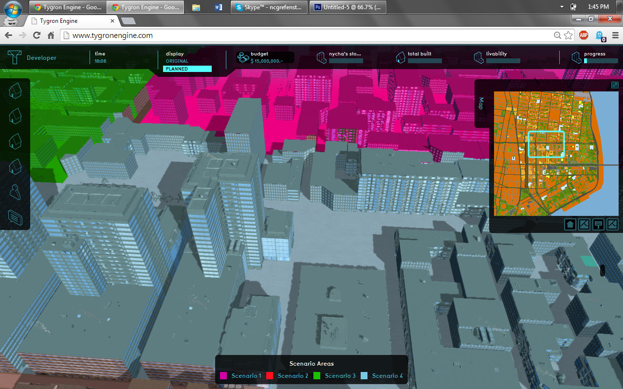
The project has four scenarios (or focus areas) where transfer of development rights can potentially happen. The four different focus areas have been identified based on the existing real estate dynamics at play in the LES, and as such the 'Scenario Zone' overlay should be used as a guideline for areas of intervention.
For the sake of simplicity, all land is under private developer ownership, other than the Baruch Campus (where NYCHA can exercise certain actions). In reality, it would belong to a variety of private and public owners.
Stakeholders
New York City Housing Authority (NYCHA)
Primary Objective: Sell air rights to developers who need it at $125 per sq ft. NYCHA is also responsible for maintaining atleast 20% affordability in the new/proposed developments.
Actions: Communicate with the city regarding the developer's building choices. Add infrastructure such as parks, community centers, etc. that can enhance Baruch Housing Campus.
Goals/Targets: Sell as many sq ft of air rights as possible. Maximum underused sale-able land = 800,000 sqft Maintain at least 20% of affordable units in the new/proposed construction. Improve the existing Baruch Housing stock and thereby increase the general livability in the area.
City of New York
Primary Objective: Allow for increased density in the area by issuing rezoning permits where required without decreasing the livability conditions in the neighborhood. Secondary objective is to maintain at least 20% of affordable units in the new developments.
Actions: Approve proposed development Approve for rezoning when proposed by the developer
Goals/Targets: Increase Density in LES, but do so with consideration for the nature of the neighborhood's urban fabric Increase affordability in LES
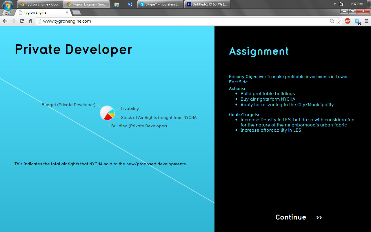
Private Developer
Primary Objective: To make profitable investments in Lower East Side.
Actions: Build profitable buildings Buy air rights from NYCHA Apply for re-zoning to the City/Municipality
Goals/Targets: Increase Density in LES, but do so with consideration for the nature of the neighborhood's urban fabric Increase affordability in LES.
Overlays
Zoning for receiver sites
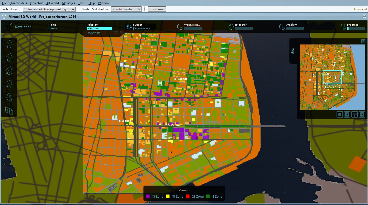
As described above, receiver sites are considered when Built FAR < 50% Zoning FAR. We then add a color coding overlay to show the current maximum allowed building height (simplified as # of floors), that can be turned on and off during a session.
-
 Private Developer Receiver Sites
 -
 Planned Receiver Sites
 -
 Overlay Scenario 1 (Zoning Baruch)
 -
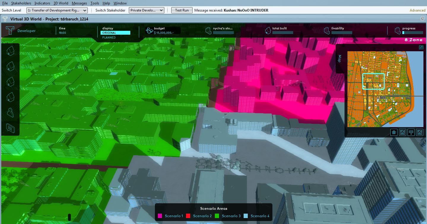 Overlay Scenario's (Close up)


Ownership
Note: For the sake of simplicity, all land is under private developer ownership, other than the Baruch Campus (where NYCHA can exercise certain actions). In reality, it would belong to a variety of private and public owners
-
 NYCHA Property: Stakeholder view
 -
Property Ownership: Overview

Actions
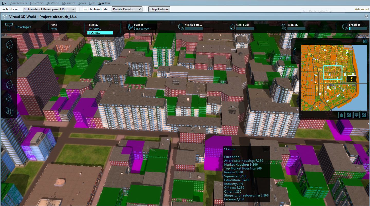
The private developer, for instance, has various menus offering different building types, that are only appropriate to build in certain zones. The deploy session below will go through this process in more depth, but you can already see that each building has been coded as A/B where:
A: # allocated to current zoning (i.e. 8, 13, 15, 22) B: # allocated to the new desired building height.
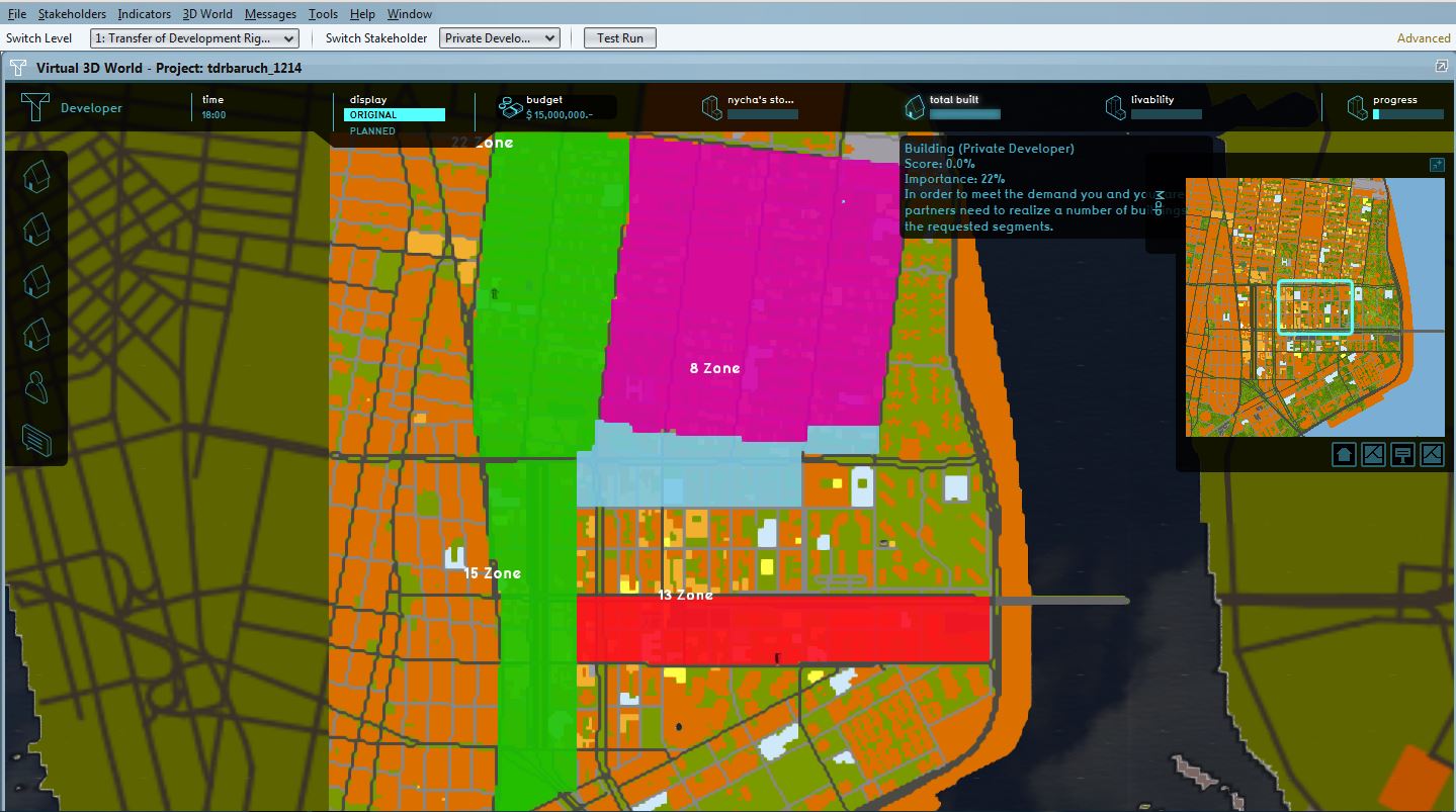
Pictures 2 & 3 show a building that should not be built, because the current zoning does not allow it.
-
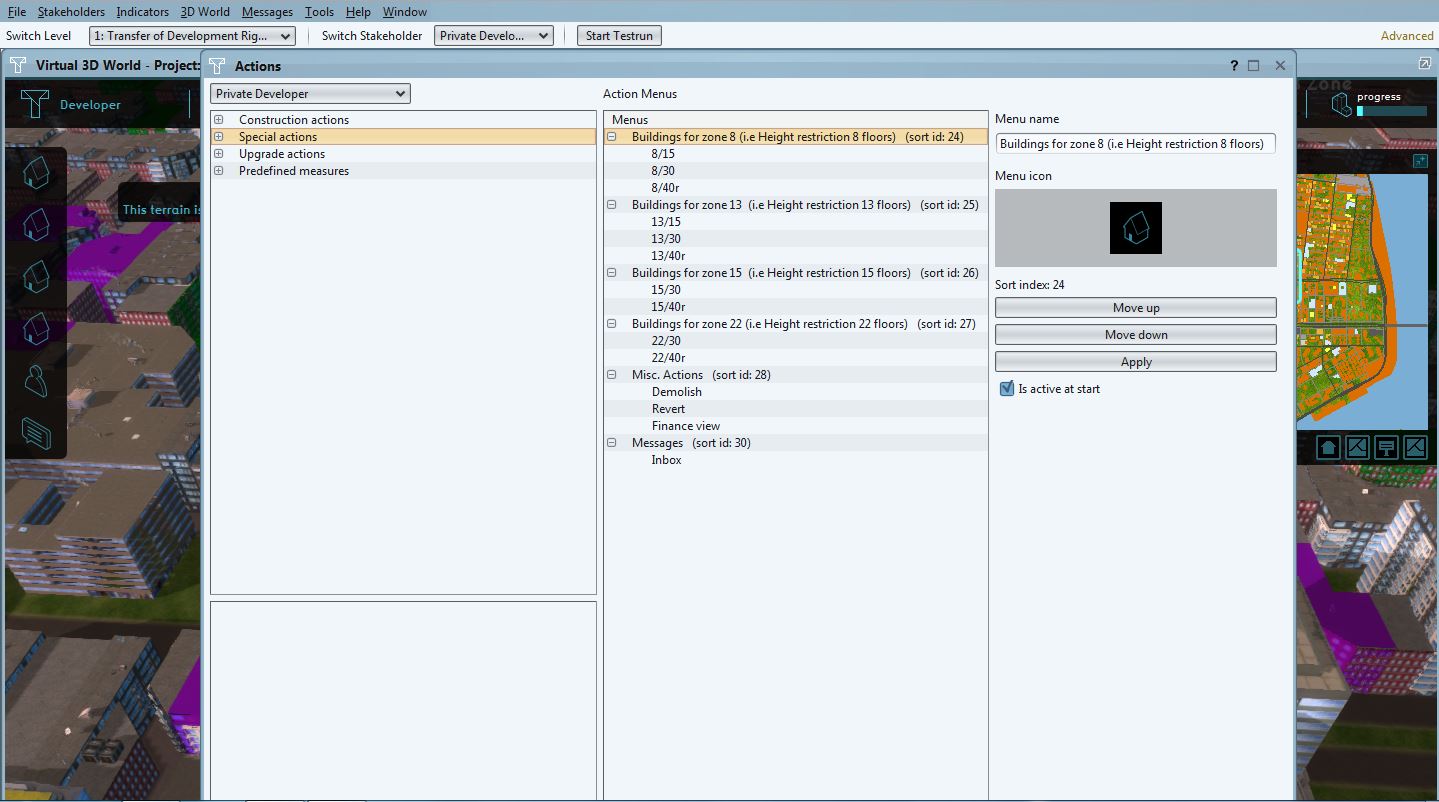 Picture 1. Buildings per Zone
 -
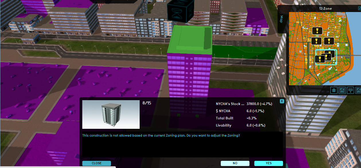 Picture 2. Zoning Plan does not allow this construction
 -
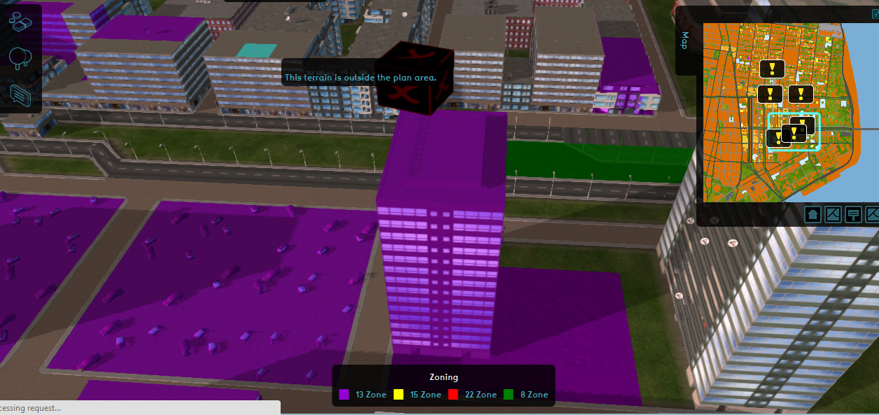 Picture 3. Stakeholder cannot build outside the plan area


Function Values & Custom Function Values: screenshots
-
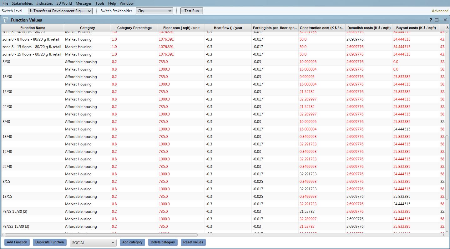 Function Values: Housing
 -
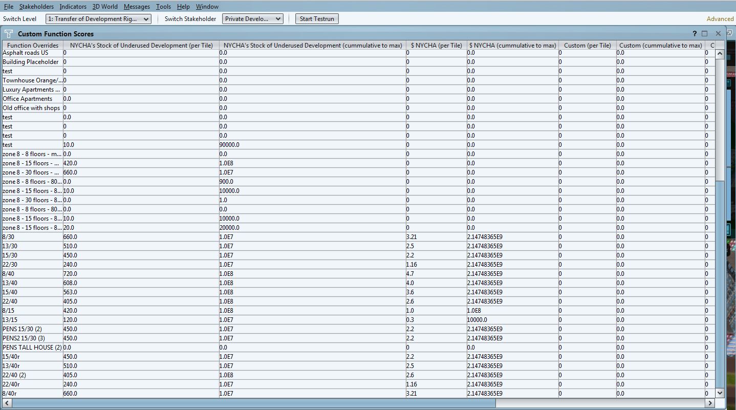 Function Scores: Development Classifications


Indicators: screenshots

Summary

The Showcase: Deployment Narrative by Kushan and Nico
-
 Involved Stakeholders
 -
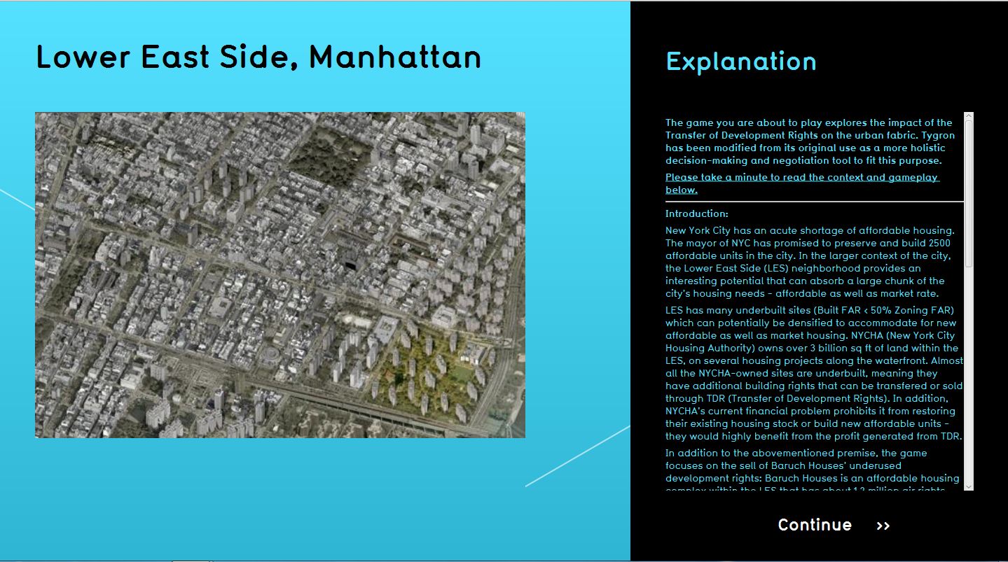 Explanation
 -
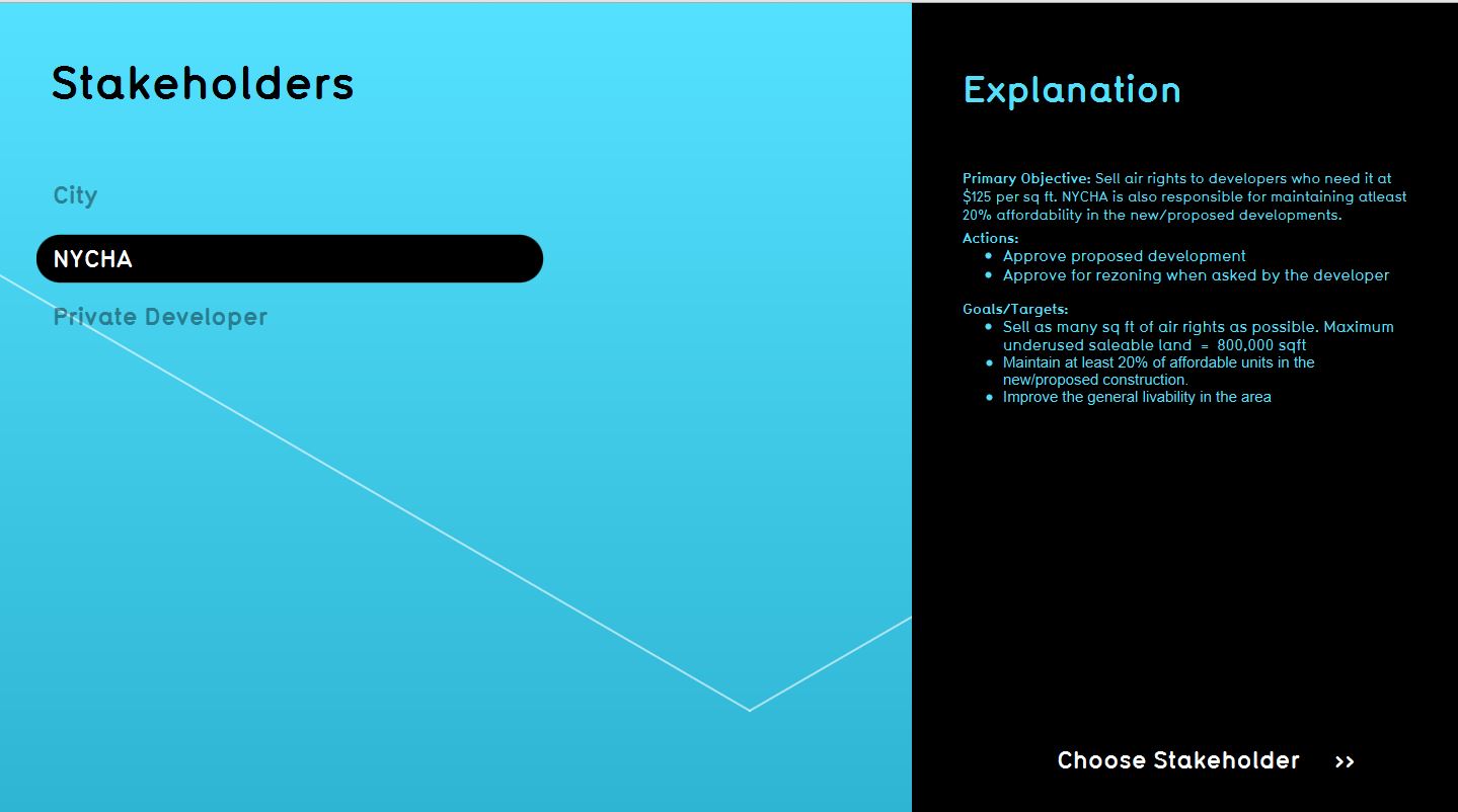 Choose a Stakeholder


"We played a session to explore the topic of TDR in one scenario area in the Lower East Side. Kushan Dave (MRP, Cornell), Nicolas Grefenstette (MRP, Cornell), Swati Sachdeva (Urban Designer, UC Berkeley) played each as one of three stakeholders (Respectively the developer, city & NYCHA). The session lasted 40 minutes, and we focused on the Scenario 4 area (around Houston Street). As a reminder, the scenario overlay should be treated as a guideline, but it doesn't need to be enforced. The decision for these four areas comes from our previous research looking at land use, economic and transportation corridors, as well as from comments from various professors and professionals in NYC.

What you will see below is the narrative for this session, followed by detailed screenshots depicting each stakeholders' actions. We encourage you to explore the project yourself, as scenarios can greatly differ in length & size (depending on the choice of buildings)".
-
 Starting Cinematic
 -
-

The developer initiates the session, by looking at the zoning/soft-site layer, identifying sites he might be interested in. By choosing to place a certain block, a prompt appears on the city's screen, asking him whether or not he will approve of the development (via permits). All stakeholders are aware of the impact of this building on various indicators (livability, affordability units, the quantity of air rights transferred and so on). At this point, the city should also be aware of the physical impact the developer's decision will have on the neighborhood. Before approving this building, stakeholders need to discuss the impact.
The first building is approved, and the developer chooses to look at a different site. This time, the site is already built, so he needs to demolish the existing building first. The first two actions are repeated, as different stakeholders discuss the suitability of each building development. In the end, the city had approved the maximum allowed number of developments (effectively using all 800,000 sq ft of underused development rights from Baruch Campus). Please note that at all times, NYCHA can match the profits made from the sell of development rights to the costs of building community & ecological infrastructure on campus, suggesting that the profits made should be reinvested into NYCHA campuses (i.e. we could have also looked at maintenance).
At the end of the session, each stakeholder can look at his performance metrics for different indicators. This stage is crucial in determining whether or not different goals were satisfactory. We choose not to beam a comparison chart at the end, since the focus needs to remain on the topic of TDR, rather than focusing on an arbitrarily set score for stakeholders.
'Stakeholder: Developer'
-
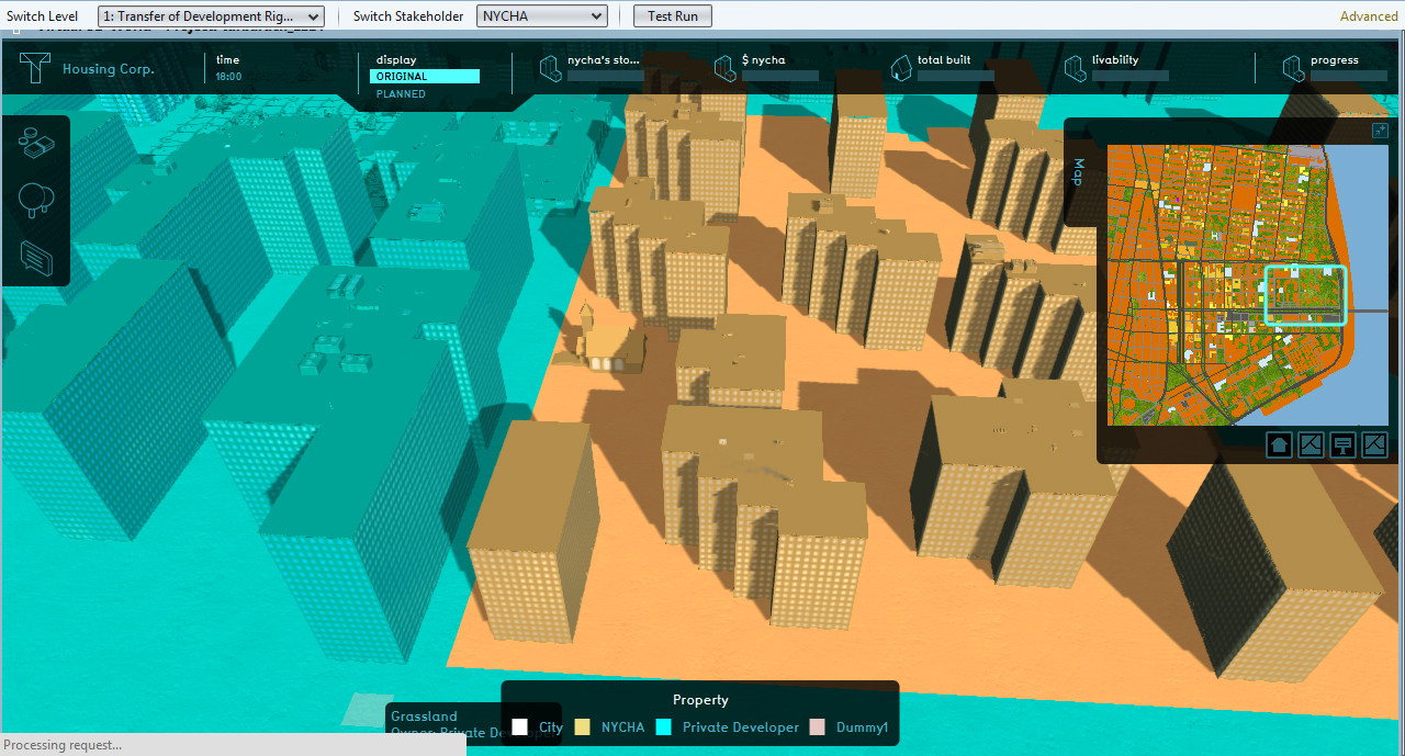
 Start screen
 -
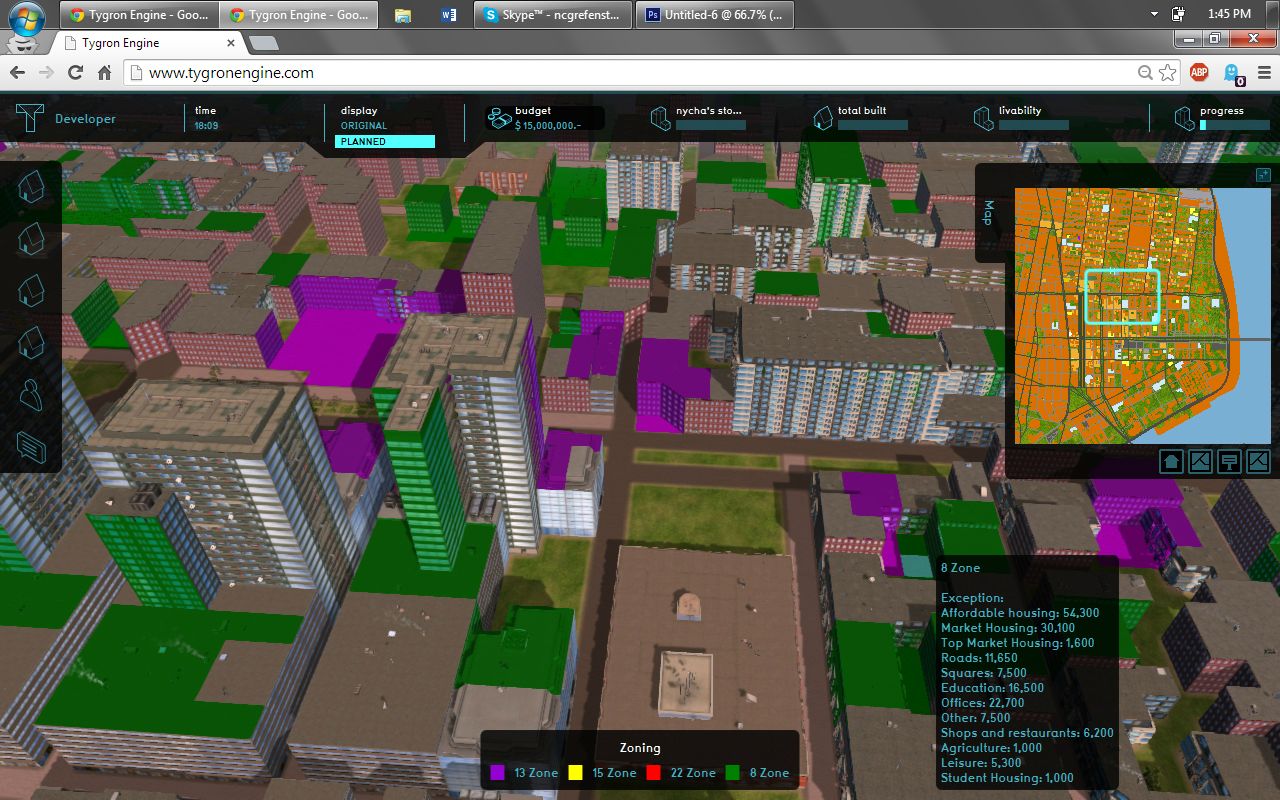
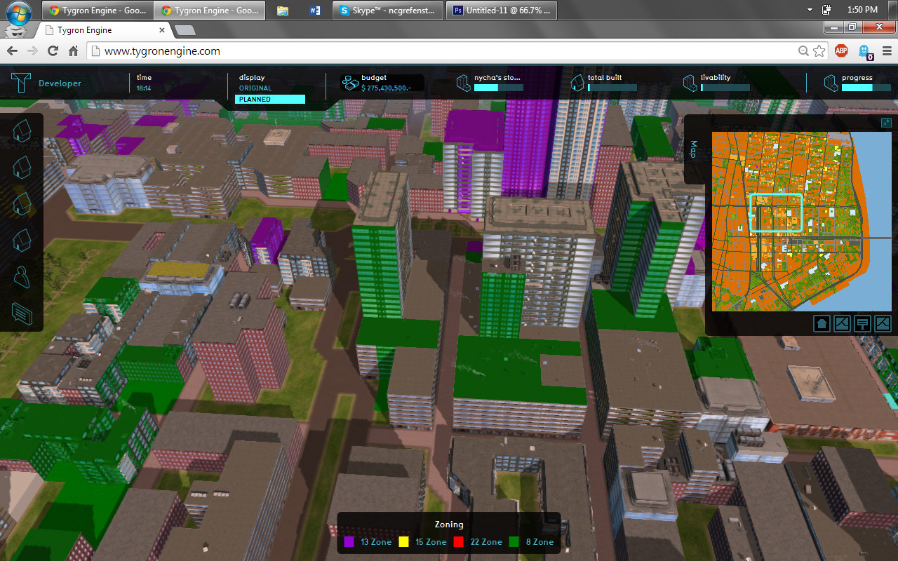 Zoning


Analysis of potential receiver sites
-
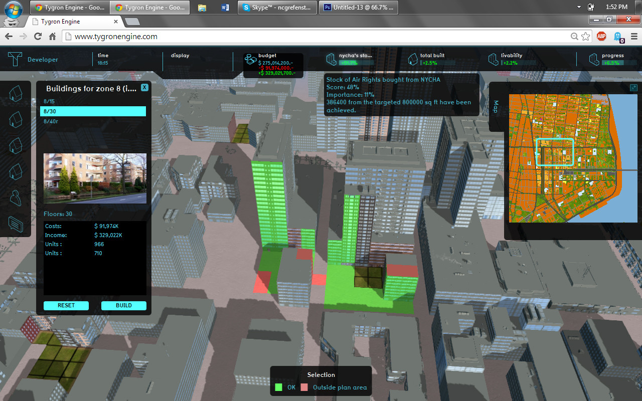
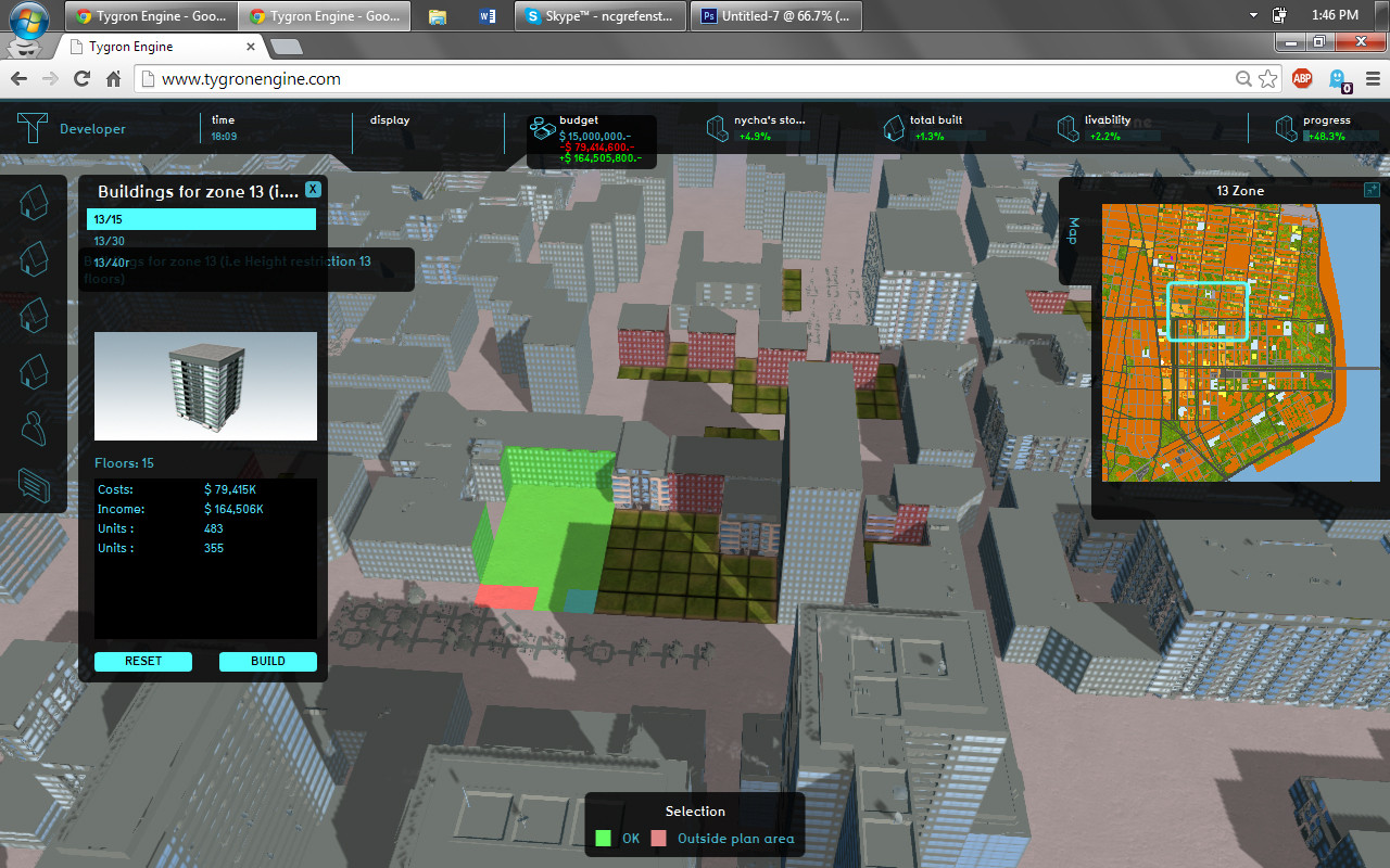 Building zone 13
 -
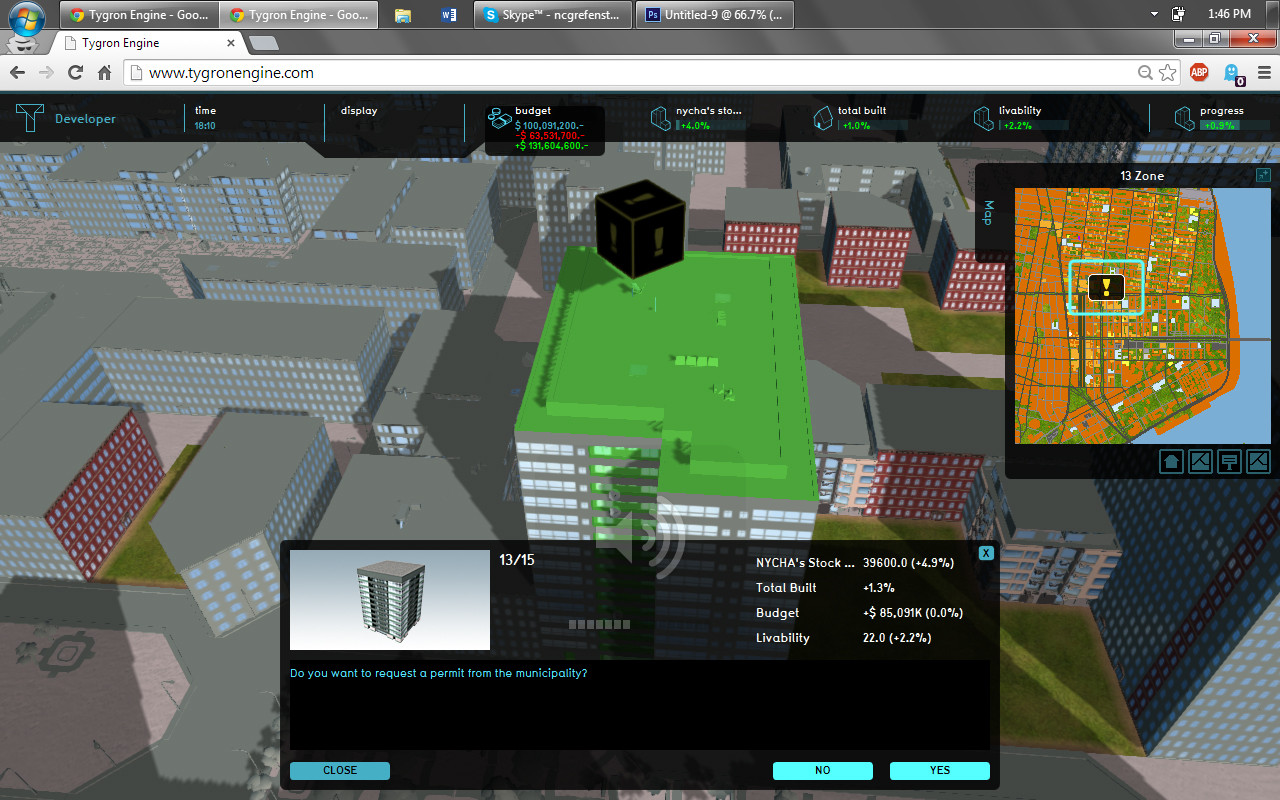 Applying for a permit
 -
 Buying air rights from NYCHA
 -
 Approved!


Closer study of the site
-
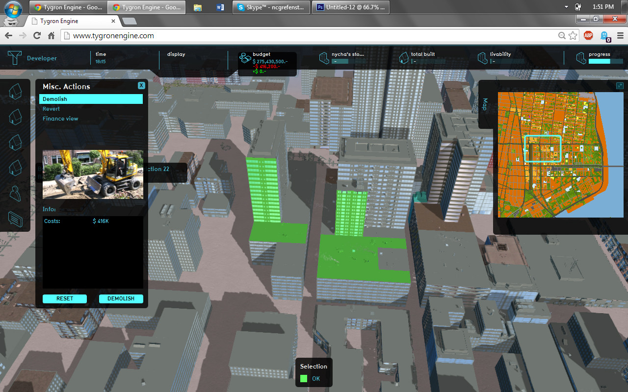 Demolishing
 -
 Deciding on placement
 -
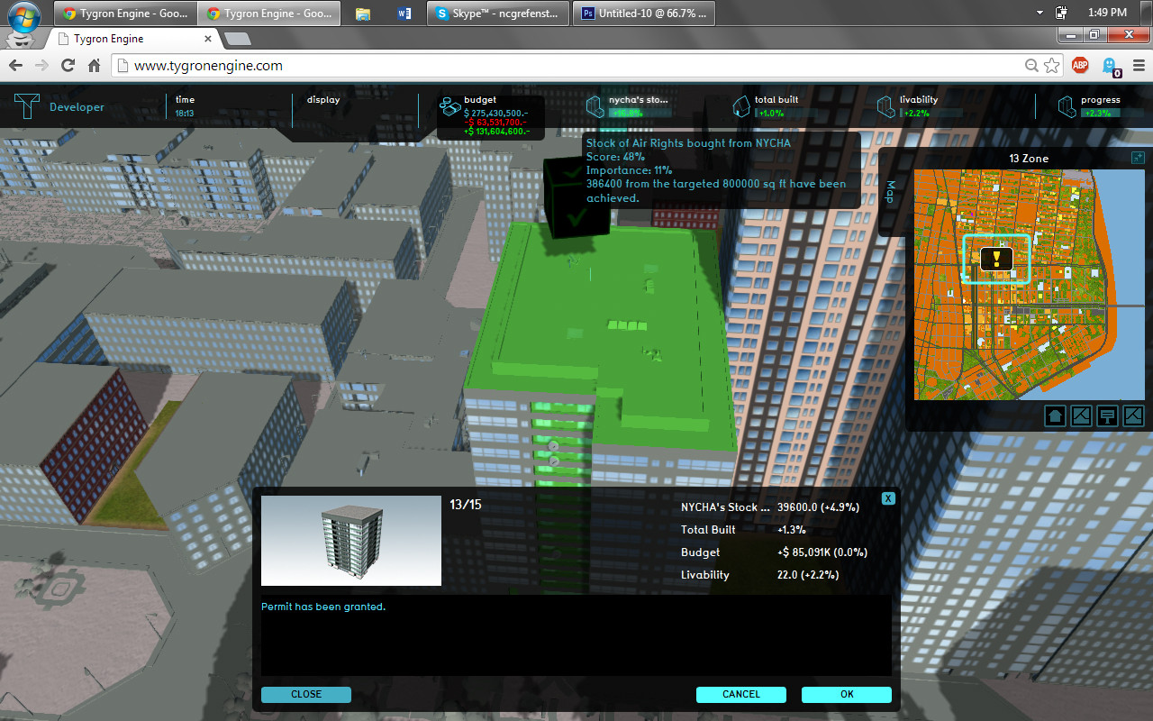
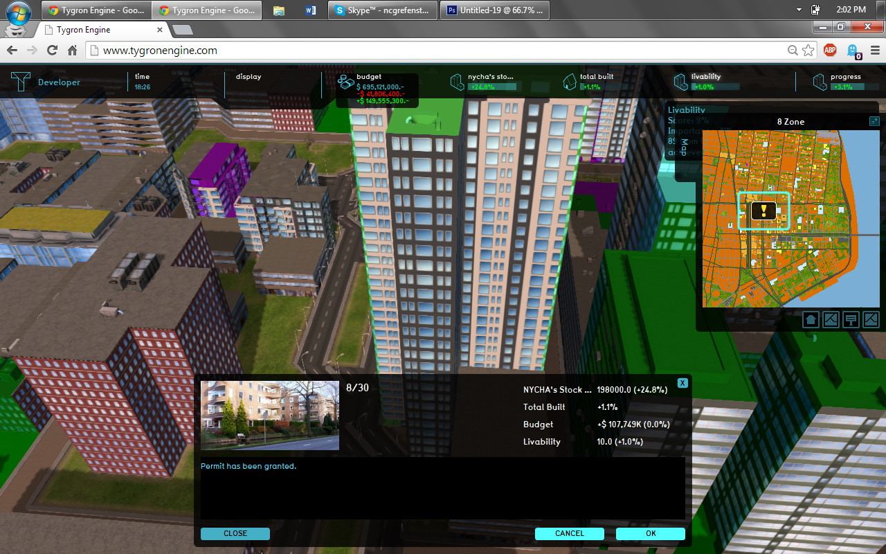 Prepare for Development, Permit has been granted


Again, the city approves! Eventually, several sites are proposed, and intra-stakeholder conversations start.
-
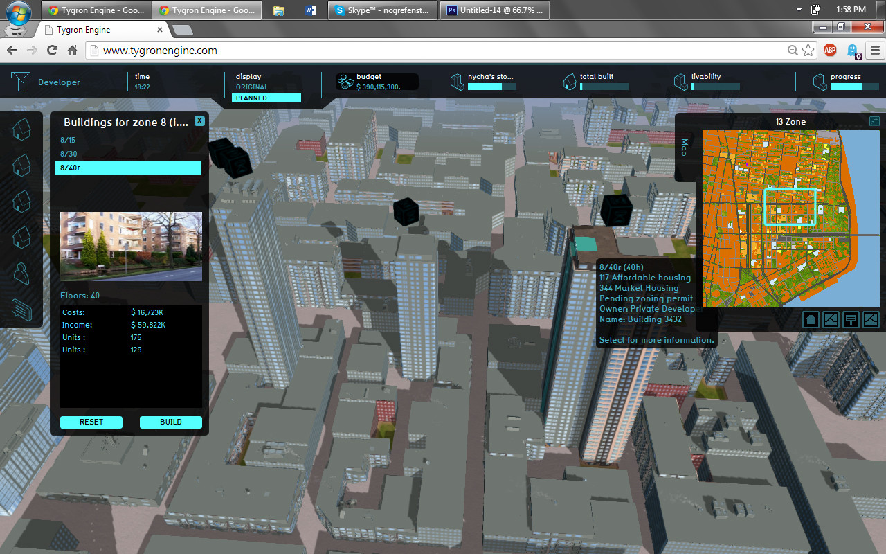 Planning for Affordable and Market housing, waiting on a zoning permit.

Summary of tables shows the progress
-
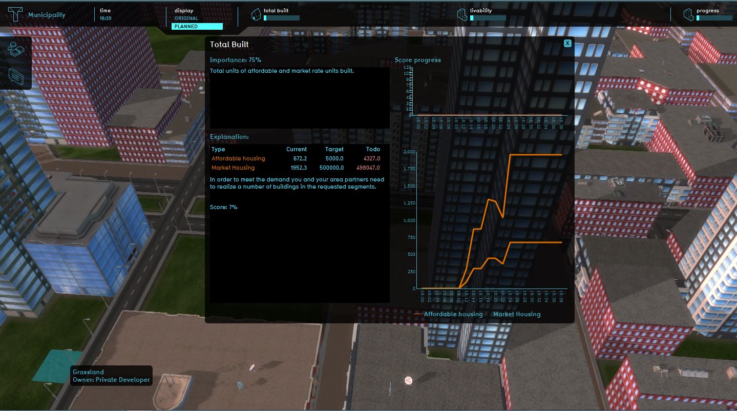
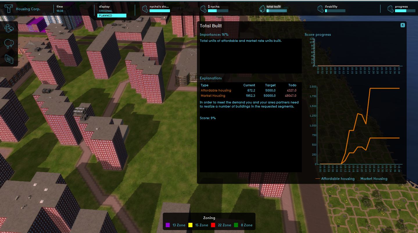
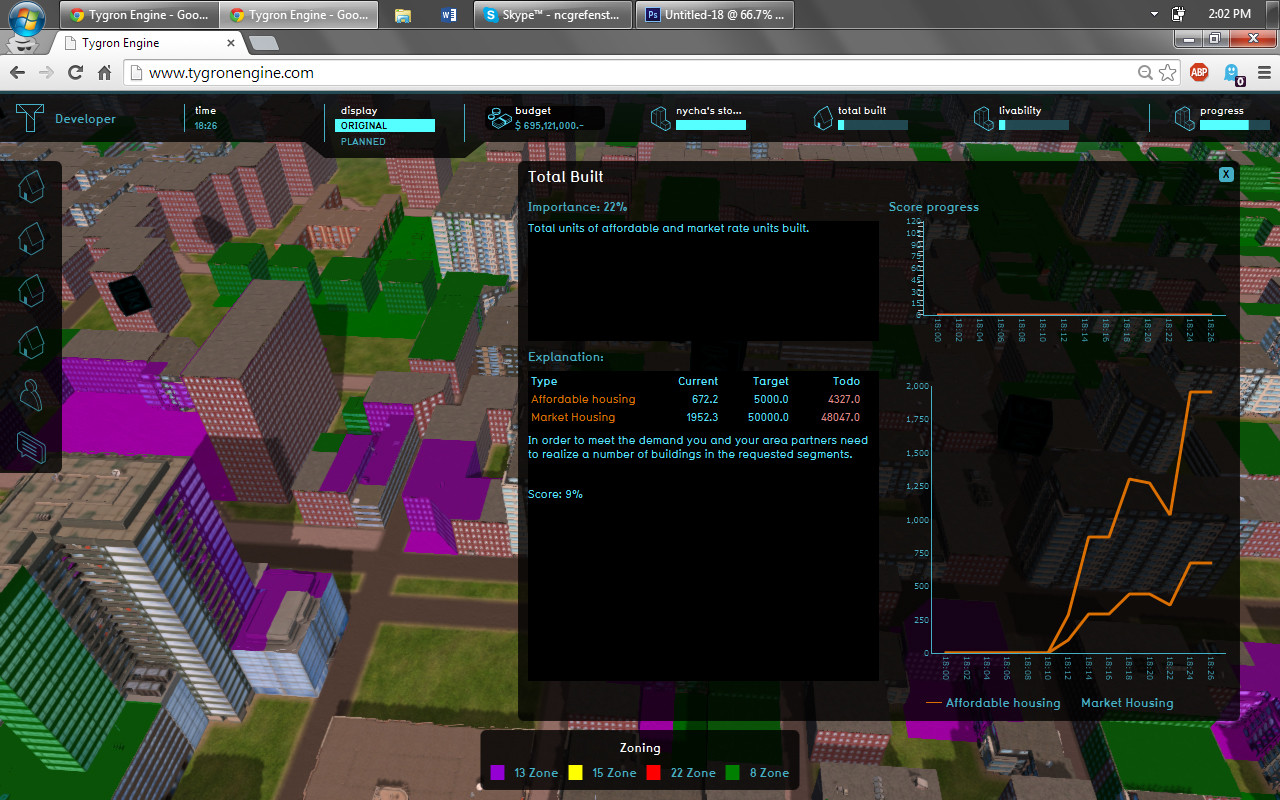 Total affordable and market housing built

We can see how different actions affected indicators throughout the project session - for instance, the dip in the total units built curve above is due to the demolition of old housing, which inevitably affects the market/affordable housing quantity & mix.
-
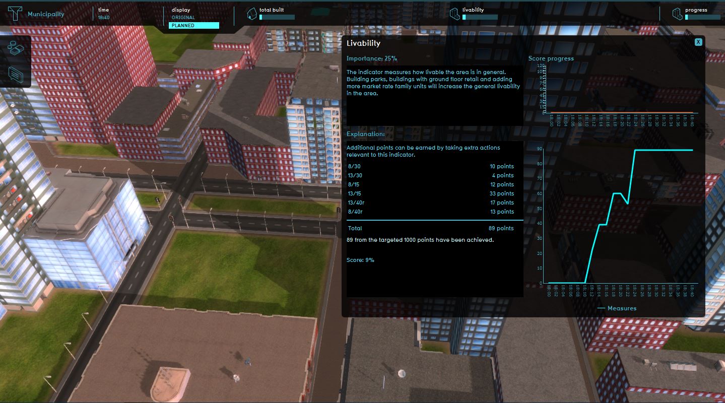
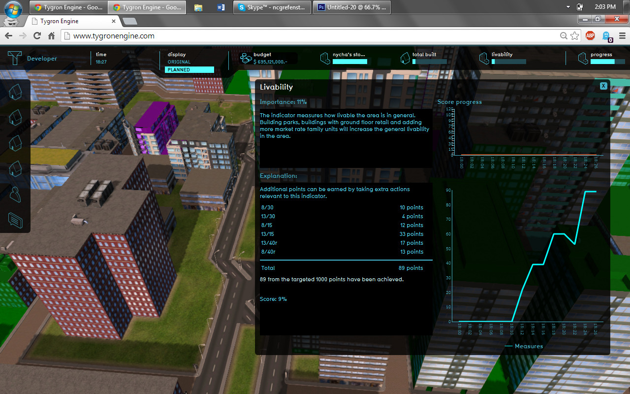 Progress in Livability
 -
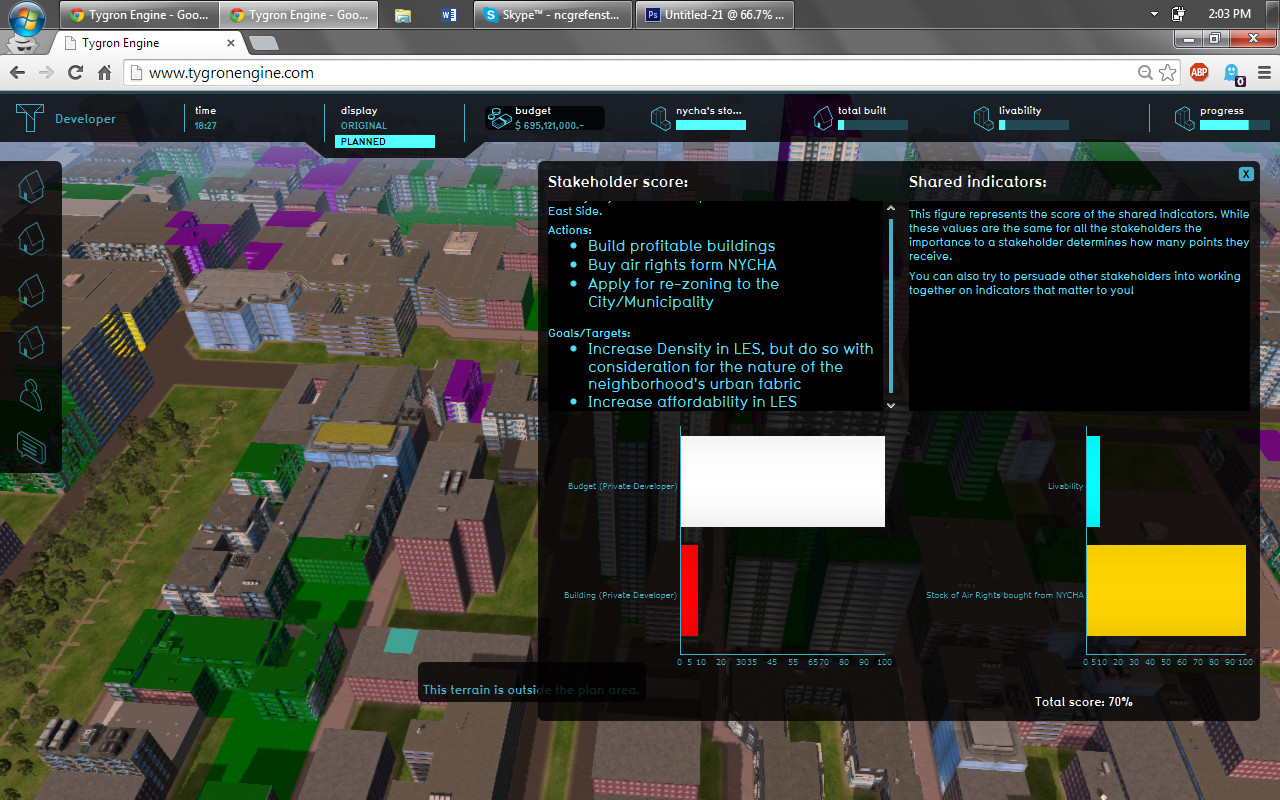 Developer's total score, including shared indicators


'Stakeholder: City of New York'
As you can picture, from the city's perspective, the role is mainly about regulation. Below, you will see what happens when the developer wants to build a 15-story building in a zone that only allows 13 floors
-
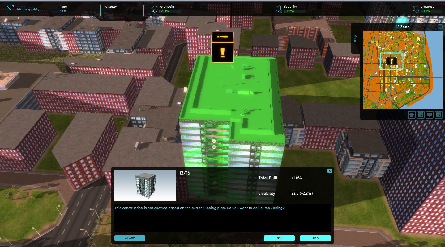 Permit rejected due to zoning plan
 -
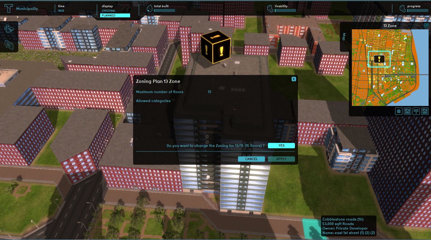 The municipality has the option to change the zoning plan from 13 to 15 floors


As the session progresses, more & more requests appear:
-
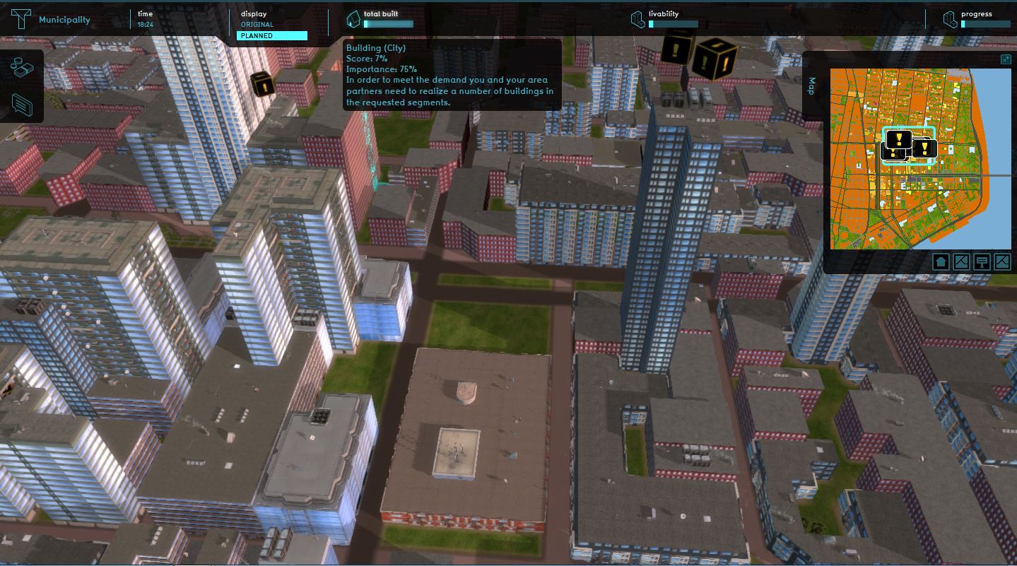 More requests to develop
 -
 Progress summary for Livability
 -
 Progress summary for Total market and affordable housing


'Stakeholder: NYCHA' Previous step, from NYCHA's perspective (we can see that NYCHA is concerned with a larger amount of indicators, although it is rather powerless in this project).
-
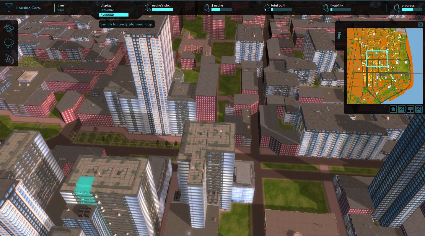 NYCHA's perspective
 -
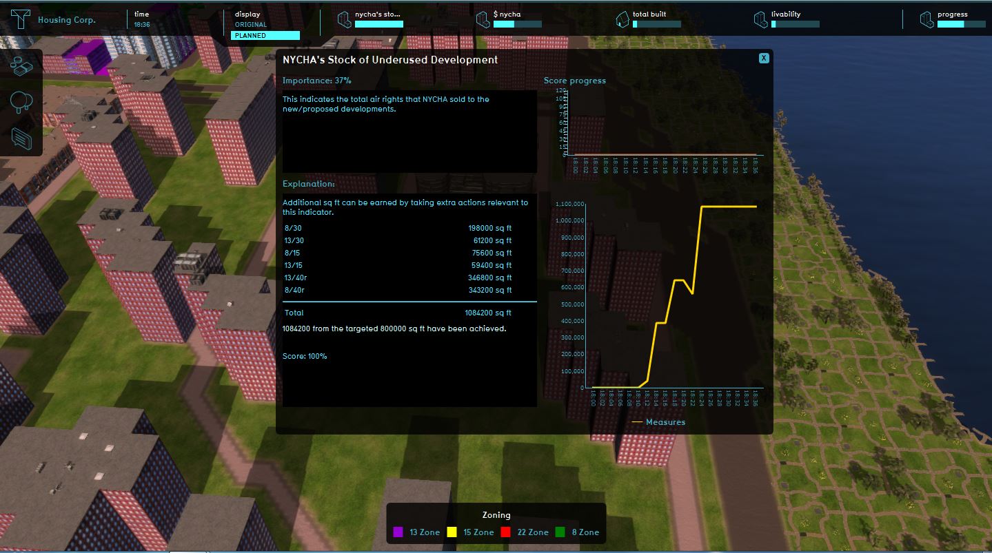 Stock of underused development
 -
 Progress summary for Total market and affordable housing
 -
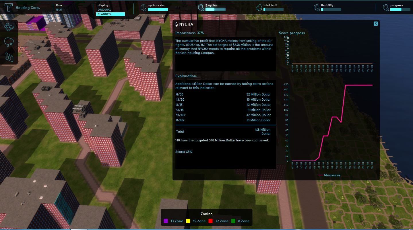 Progress summary for NYCHA's profit
 -
 Progress summary for the Livability in Baruch


Concluding remarks

From the session:

First, we notice that transferring development rights has a positive impact on finances for all stakeholders. As mentioned in our introductory post, they are priced at $125/sq.ft. & allow for greater flexibility in development options, where zoning might be restrictive. Please note that indicators such as livability do not have a set target that needs to be achieved, but should be read as a scale for the impact of different development actions.
-
 Situation before analysis
 -
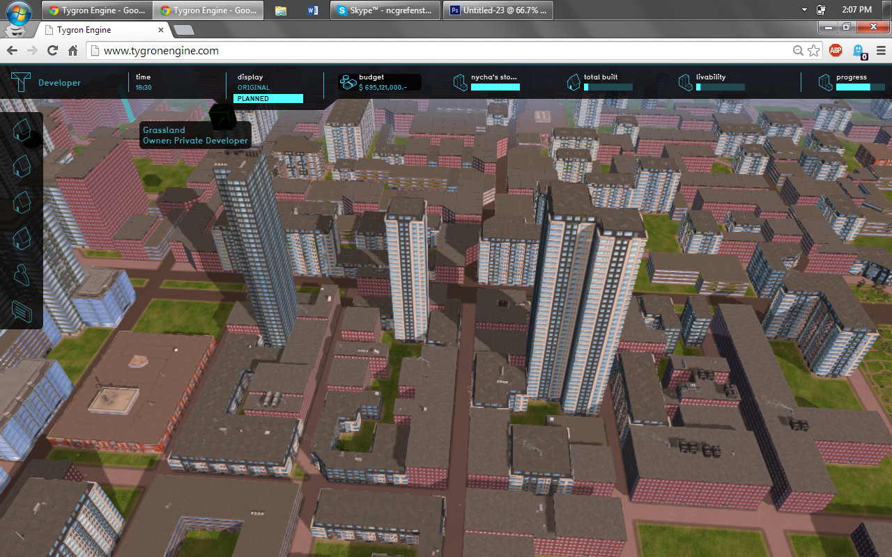 Situation after analysis
 -
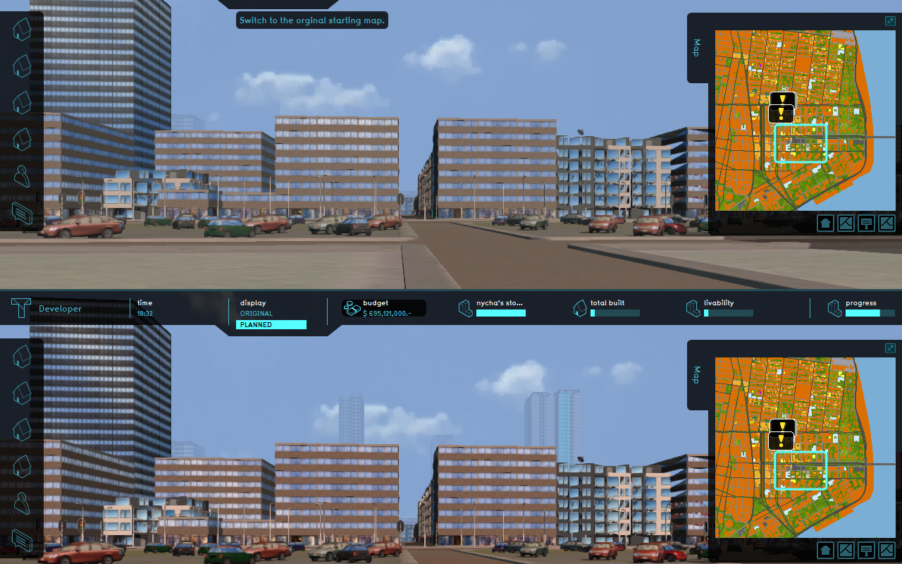 Before and After view of the plans


While only a few actions were executed, the session did last 45 minutes, due to the discussions sparked by different decisions. We can directly see that larger buildings might use TDR more effectively, but can really stand out in certain neighborhoods. On the other hand, the developer can also be more balanced with his approach, choosing to build several smaller buildings, in order to fit within the urban fabric. This tool was used to creatively explore the topic of TDR, since this was not originally supported in Tygron. While useful, it also means we had to make some sacrifices on some of the other features of the project (i.e. painting a larger picture with stakes in environmental & social issues, for instance). However we believe that incorporating height as an effect on some of the preset indicators (i.e. livability), would be a useful next step since visual impact is an important criteria in the Environmental Impact Assessment (EIA) of NYC.

Further limitations:
- Function values & custom function values do not respond to the same type of input. It was challenging to work around this issue of air rights (for floors above current zoning restrictions), without manually inputting square footage values for each new custom building types. Ideally, it would also be nice to be able to raise existing buildings. Buildings are also hard to edit or customize (a lot of them are grouped) - it would be nice to have the option to create new typologies from scratch.
- NYCHA's role: We would have liked to give NYCHA a more active role in this project (right now, it is more of a silent stakeholder), by allowing it to make repairs on its existing campuses based on the profits made by the sale of development rights. Currently, restoring old social housing only works on certain building typologies that were not possible to be used based on height limitations.
- In addition to the above point, it would be great to have an option to rate 'how much' a particular building needs to be repaired either in % or $ value. We do understand that there can be tweaks, but if there is a direct option, it makes it easily playable.
- Link between the software and spreadsheets: ideally, it would be nice to be able to create our own links between different function value cells (i.e. like in Excel, linking between different sheets). Interoperability was also impeded, since we had to manually input the real estate data from our previous proforma work.
- It would be great if the stakeholders can look at the before/after image before approving or proposing a building. We feel that its a great way to assess the visual impact on the contextual urban fabric.

Nonetheless, we had a lot of fun creating this project and hope you will too, exploring it. It is saved under 'TDR Baruch CRP', please feel free to play!

NG
KD
Tygron is happy to conclude that this showcase, created by Kushan and Nicolas, was flawlessly executed.
The critical challenges facing public housing are becoming more important as populations are migrating to urban areas.
Focusing on including all stakeholders in decision making, integrating urban design, planning and real estate economics can really enhance a planning process.
The quality of this project, as well as the creativity shown working with the {{software}} is great.
Tygron really appreciates your recommendations, and has gained a better understanding of Transferring Development Rights basics.
Therefore we would like to thank you for taking part, and of course congratulate you on your achievements.
The Tygron Team.
With this project, Kushan and Nicolas won the Tygron Student Contest.