Visualize levee breach from water body inside project area use case (Water Overlay): Difference between revisions
(Created page with "In this scenario we want to simulate a levee breach near an adjacent waterbody. ''In this example, the whole waterbody is present in the 3D project.'' This is important to not...") |
mNo edit summary |
||
| Line 1: | Line 1: | ||
When a levee breaks water is free to flow through the breach and onto otherwise dry land. There are multiple ways of simulating a breach in a levee. | |||
This scenario assumes the water body from which water will flow through the levee is located in the project area in its entirety. | |||
==Requirements== | |||
| | Before implementing this use-case, make sure you have a [[Basic water model use case (Water Overlay)|basic water model]] set up. For the specified scenario, the [[Flooding_(Overlay)|flooding overlay]] is required. | ||
|Add a new | |||
| | Also ensure the following in your project, if possible: | ||
* The hydrological system has a SURFACE_LAST_VALUE or WATER_STRESS [[Water Overlay#Result_types|result type]], either as main result or as a child result type. | |||
| | * The simulation is set up to output a reasonable amount of timeframes. For a stabilization case, one timeframe per 12 hours of simulation time is reasonable. | ||
| | <!--Before implementing this use-case, make sure you also have a dataset containing information on the breach(es) you wish to model. | ||
The following data should be prepared. Click on any topic for more information. | |||
{|class=wikitable | |||
!Data | |||
!Description | |||
!Alternative/default | |||
|- | |||
|[[Breach (Water Overlay)|Breach]]es | |||
|Breaches define a lowered terrain height, creating a hole through which water can flow | |||
|Breaches are not automatically provided or generated | |||
|}--> | |||
==Steps== | |||
{{Editor steps|title=manually add a breach | |||
|Configure a base hydrological system. | |||
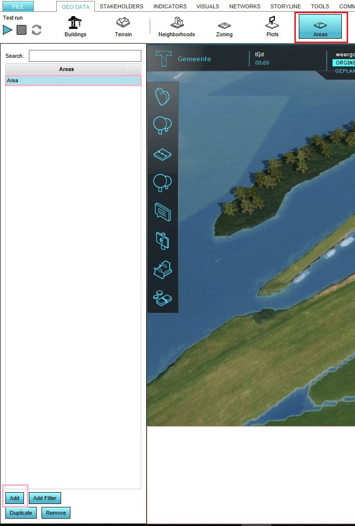
|[[How to add and remove an area|Add a new Area]] to the project. | |||
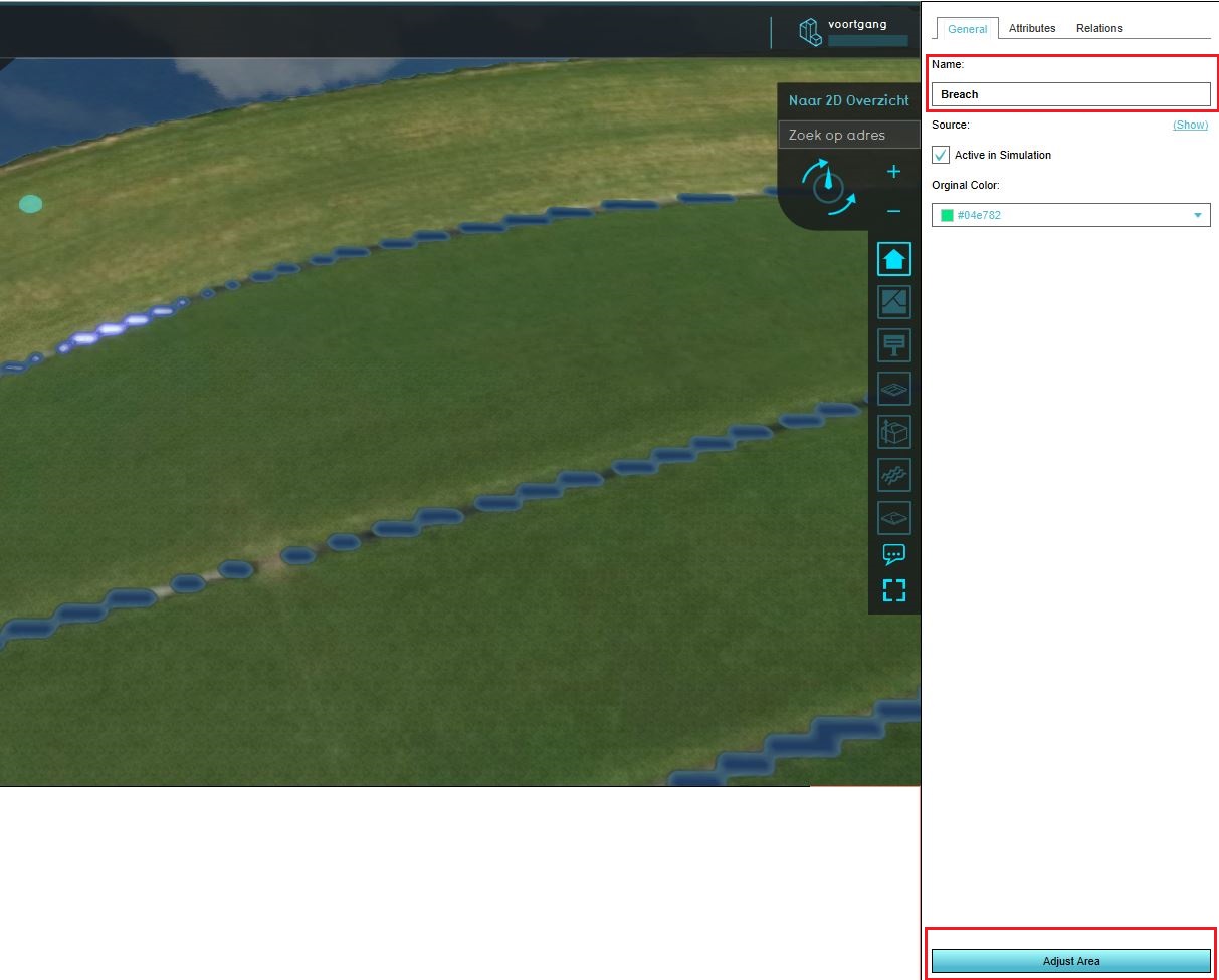
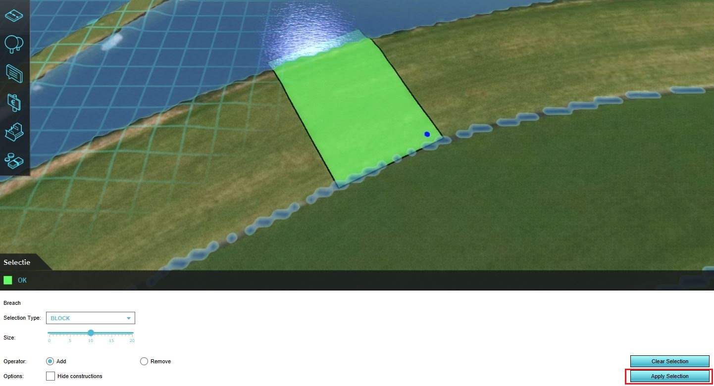
|Draw the Area in the location where the breach should take place. Make sure it extends all the way from the water to the floodable land. | |||
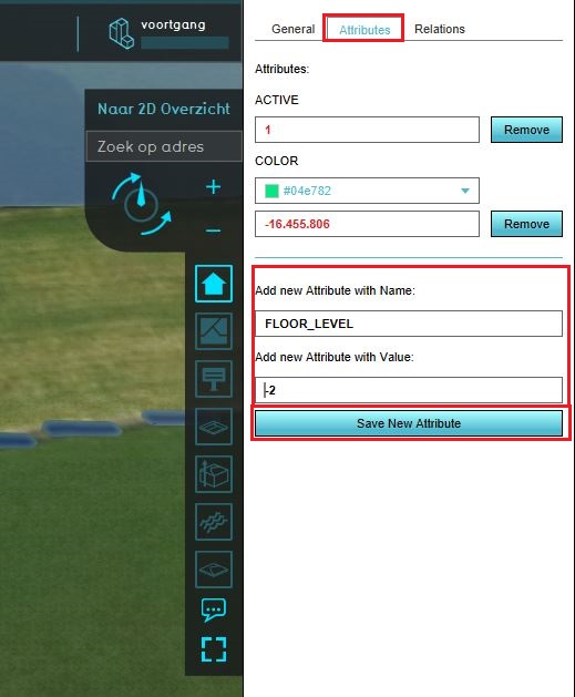
|Add the [[Breach height (Water Overlay)|breach height] attribute to the Area. | |||
|Ensure the overlay is (re)calculated. | |||
|Inspect the "Surface last value" result overlay. | |||
|Select the "play" option in the overlay's legend. The animation will show the flow of the water from the breach. | |||
}} | }} | ||
<gallery mode=nolines> | <gallery mode=nolines> | ||
File:Create_area.JPG | File:Create_area.JPG | ||
| Line 19: | Line 40: | ||
</gallery> | </gallery> | ||
==Notes== | |||
Multiple breaches can be added to the same project. | |||
Revision as of 11:44, 9 April 2019
When a levee breaks water is free to flow through the breach and onto otherwise dry land. There are multiple ways of simulating a breach in a levee.
This scenario assumes the water body from which water will flow through the levee is located in the project area in its entirety.
Requirements
Before implementing this use-case, make sure you have a basic water model set up. For the specified scenario, the flooding overlay is required.
Also ensure the following in your project, if possible:
- The hydrological system has a SURFACE_LAST_VALUE or WATER_STRESS result type, either as main result or as a child result type.
- The simulation is set up to output a reasonable amount of timeframes. For a stabilization case, one timeframe per 12 hours of simulation time is reasonable.
Steps
{{Editor steps|title=manually add a breach |Configure a base hydrological system. |Add a new Area to the project. |Draw the Area in the location where the breach should take place. Make sure it extends all the way from the water to the floodable land. |Add the [[Breach height (Water Overlay)|breach height] attribute to the Area. |Ensure the overlay is (re)calculated. |Inspect the "Surface last value" result overlay. |Select the "play" option in the overlay's legend. The animation will show the flow of the water from the breach. }}
Notes
Multiple breaches can be added to the same project.


