How to fix a GeoTIFF that has an invalid NO DATA value: Difference between revisions
No edit summary |
No edit summary |
||
| Line 10: | Line 10: | ||
{{editor steps|title=How to fix a GeoTIFF that has an invalid NO DATA value | {{editor steps|title=How to fix a GeoTIFF that has an invalid NO DATA value | ||
| Download url exiftool: [https://exiftool.org/]. | | Download url exiftool: [https://exiftool.org/ | https://exiftool.org/]. | ||
| Once downloaded, extract the files and go into the exiftool folder. | | Once downloaded, extract the files and go into the exiftool folder. | ||
| Create a new file and name it a name like "nodata.cmd". This will be our automated command file. | | Create a new file and name it a name like "nodata.cmd". This will be our automated command file. | ||
Revision as of 13:09, 29 September 2023
When importing a GeoTIFF into a project that you are editing, it can occur that you will receive the following error:

This error means that the metadata of the GeoTIFF for the NO_DATA value was written in the ','-number notation, instead of the expected '.'-number notation.
It is possible to fix the metadata of a GeoTIFF. You can download the free exiftool program to automatically adjust the NO_DATA-metadata.
- Download url exiftool: [https://exiftool.org/
- https://exiftool.org/].
- Once downloaded, extract the files and go into the exiftool folder.
- Create a new file and name it a name like "nodata.cmd". This will be our automated command file.
- Edit this file with a text editor (such as "Kladblok")
- Paste the code provided below into the text editor and save.
- Drag your GeoTIFF file onto this cmd-file. A command prompt window will open
- Note that it says that it says it has changed the file. Press enter to continue
- Note that the new metadata is now printed and verify that the GDAL No Data value is now correct.
- Try to import your GeoTIFF file into your project. It should no longer show the invalid NO_DATA error.
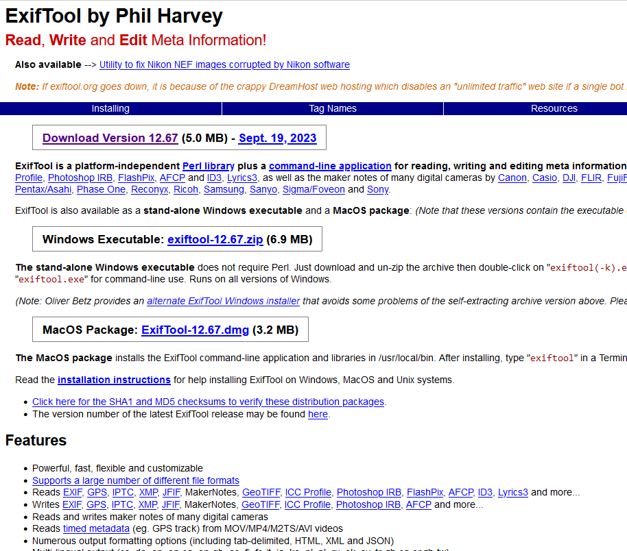
Exiftool's download page. Download the window's zip.
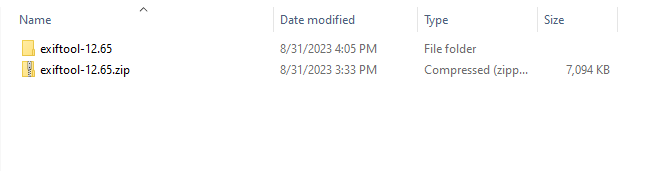
Once downloaded, extract the exiftool from the zip file.
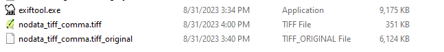
Folder with the exiftool and a GeoTIFF with invalid NO_DATA.
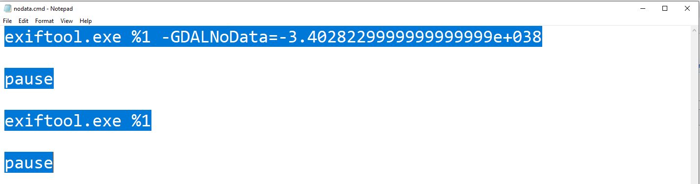
Editing the nodata.cmd file in a text editor
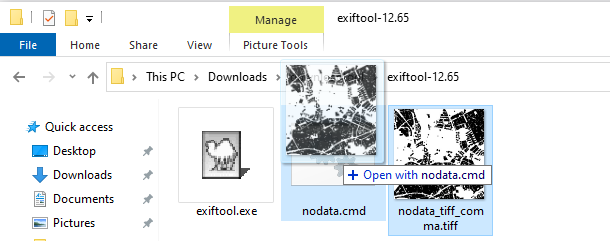
Dragging a GeoTIFF file onto the nodata.cmd file.
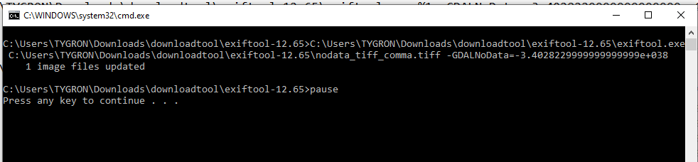
Command window opening and showing that data has changed.
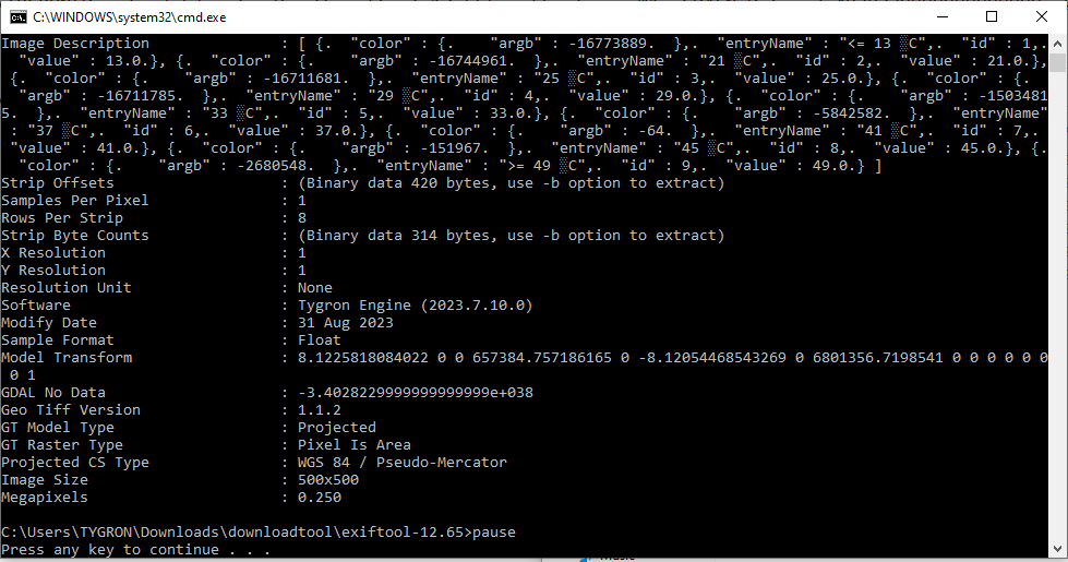
Command window showing the new metadata of the GeoTIFF.


Nodata.cmd code
The following code can be used in a cmd-file to automatically adjust the NO_DATA value of a GeoTIFF and prints the new meta-data values after pressing enter.
exiftool.exe %1 -GDALNoData=-3.4028229999999999999e+038
pause
exiftool.exe %1
pause
The %1 refers to the first argument used with our nodata.cmd file; In our case a GeoTIFF-file that you drag onto this cmd-file.
Notes
- You can also adjust the NO_DATA value to an other value than -Infinity, for example to -999.