Rasterization (Sight Distance Overlay): Difference between revisions
Jump to navigation
Jump to search
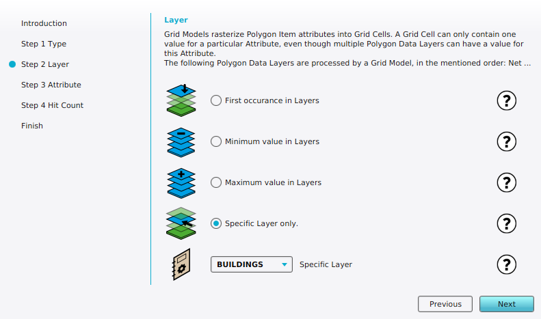
(Created page with "right|thumb|Layer step in the Sight Distance Overlay Wizard when you can select the method of rasterization. {{Overlay property|<onlyinclude> {{Overlay property|type=row|group=Sight Distance Overlay |property=Rasterization |description=The rasterization method of a Sight Distance Overlay |defaultvalue='''First''' |icon=distancewizard_icon_rasterization.png }}</onlyinclude>}} Possible values: # '''FIRST''': Attrib...") |
No edit summary |
||
| Line 21: | Line 21: | ||
* [[Grid model (Sight Distance Overlay)]] | * [[Grid model (Sight Distance Overlay)]] | ||
* [[Maplink (Sight Distance Overlay)]] | * [[Maplink (Sight Distance Overlay)]] | ||
}} | }} | ||
{{SightDistanceOverlay nav}} | |||
Latest revision as of 15:49, 2 February 2024
| Icon | Property | Description | Default value |
|---|---|---|---|
| |
Rasterization | The rasterization method of a Sight Distance Overlay | First |
Possible values:
- FIRST: Attribute: First layer
- MIN: Attribute: Min value
- MAX: Attribute: Max value
- SINGLE LAYER: Attribute: Specific layer
- GRID: Grid: Input Overlay
See also
