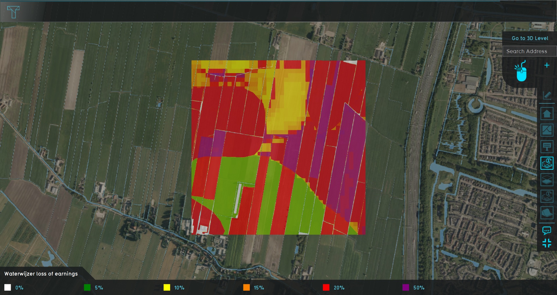
Demo Ww Agriculture Project
Revision as of 11:27, 14 July 2020 by Rudolf@tygron.nl (talk | contribs) (Created page with "{{demo project summary | title=Demo Ww Agriculture | demographic=waterboards, urban planners in rural environments, and agricultural engineers | showcases=the results of the W...")
The Demo Ww Agriculture project is available for all users and can be found in the main menu under Edit projects. This project does not count towards your license.
This project is intended for waterboards, urban planners in rural environments, and agricultural engineers.
This project showcases the results of the Waterwijzer's calculations spatially, through the connection with their API.
The demo is a project in which a location in The Netherlands used for agriculture, and with a variation of underground Terrain Types and groundwater levels. The Waterwijzer Overlay provides insight into how viable the crops are in the area.
