Heightmap Overlay: Difference between revisions
Jump to navigation
Jump to search
(Created page with "{{learned|what the Heightmap Overlay is|which additional information is displayed in the hover panel|how to add or remove the Heightmap Overlay}} ==What the Heightmap Overlay...") |
|||
| Line 1: | Line 1: | ||
{{learned|what the Heightmap Overlay is|which additional information is displayed in the hover panel|how to add or remove the Heightmap Overlay}} | {{learned|what the Heightmap Overlay is|which additional information is displayed in the hover panel|how to add or remove the Heightmap Overlay}} | ||
==What the Heightmap Overlay is== | ==What the Heightmap Overlay is== | ||
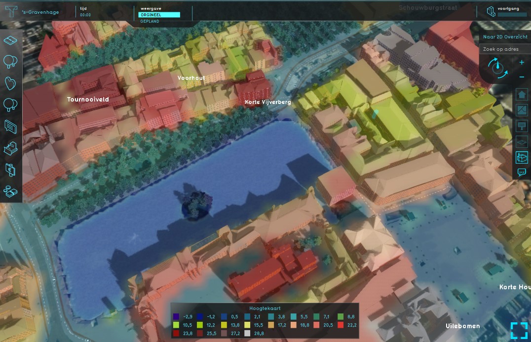
[[File: | [[File:Heightmap_overlay.jpg|thumb|420px|left|Example of the Heightmap Overlay]] | ||
The Heightmap Overlay displays the height of the terrain. The overlay becomes available for all stakeholders when added to a project. | The Heightmap Overlay displays the height of the terrain. The overlay becomes available for all stakeholders when added to a project. | ||
<br clear=all> | <br clear=all> | ||
Revision as of 10:26, 21 November 2018
What the Heightmap Overlay is
The Heightmap Overlay displays the height of the terrain. The overlay becomes available for all stakeholders when added to a project.
