Traffic Noise Overlay: Difference between revisions
No edit summary |
|||
| Line 3: | Line 3: | ||
The Traffic Noise overlay is an [[Overlay]] which displays the impact of traffic noise in DB(A) for the project area. Based on [[Traffic Flow (Overlay)|traffic flow]], distance and several computation parameters a grid is calculated for the project area. Note, this overlay only shows the impact of traffic noise on top of a background value of 48 dB(A). Influence of other sources (e.g. windmills, air traffic, factories, etc) is excluded. | The Traffic Noise overlay is an [[Overlay]] which displays the impact of traffic noise in DB(A) for the project area. Based on [[Traffic Flow (Overlay)|traffic flow]], distance and several computation parameters a grid is calculated for the project area. Note, this overlay only shows the impact of traffic noise on top of a background value of 48 dB(A). Influence of other sources (e.g. windmills, air traffic, factories, etc) is excluded. | ||
==Adding and removing== | |||
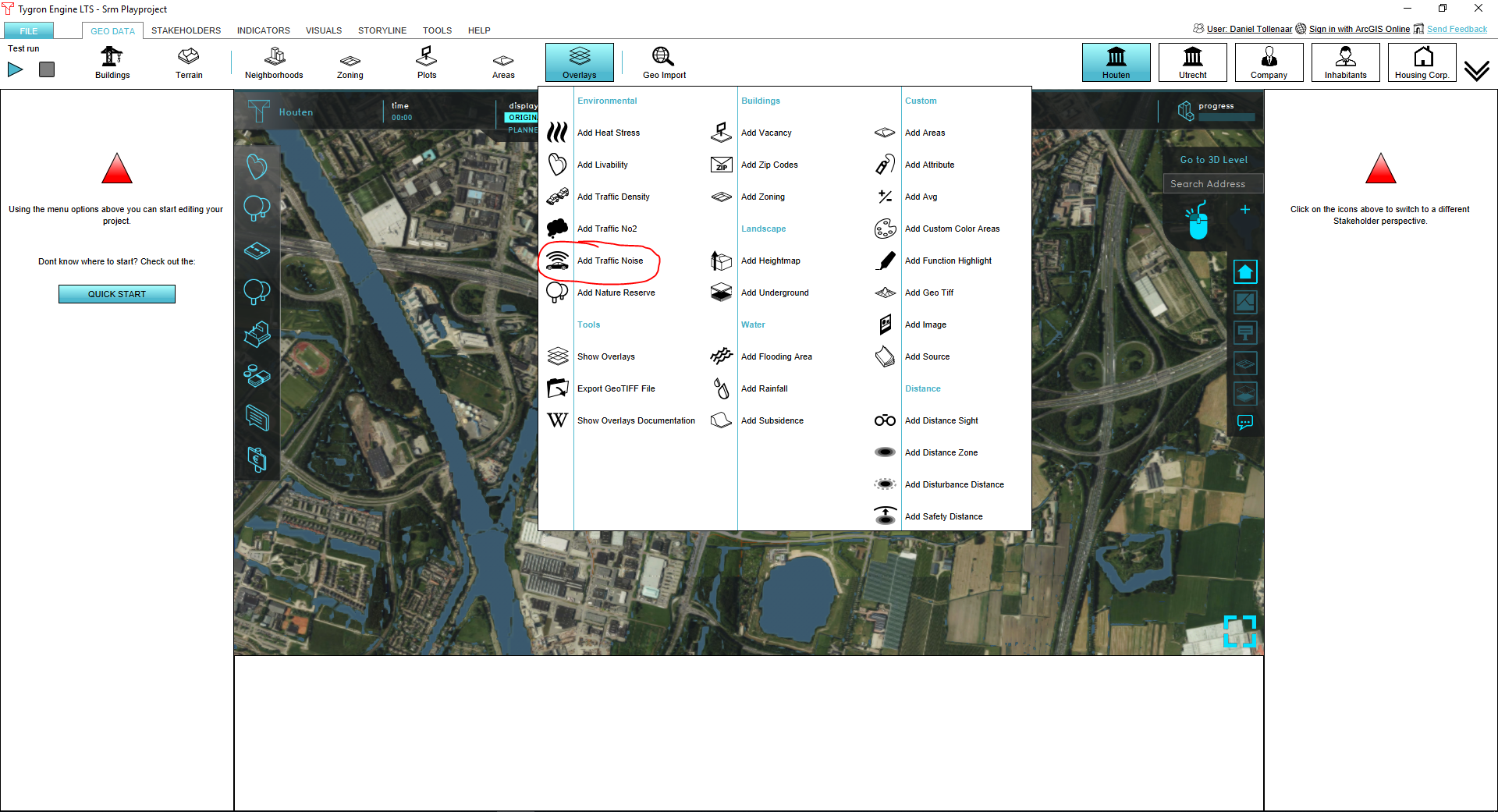
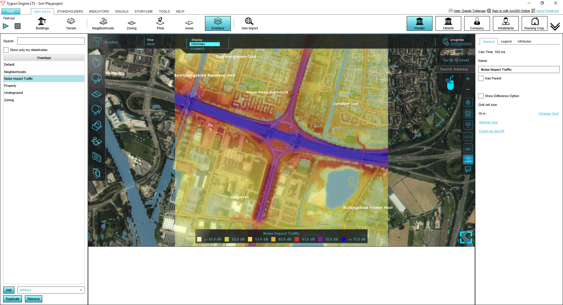
To add a traffic noise overlay go to the Overlays menu in the GEO DATA ribbon and select Add Traffic Noise. To remove the overlay, press Remove below the overlays list. | |||
[[File:Noice_overlay_01.PNG|700px]] [[File:Noice_overlay_02.PNG|700px]] | |||
==Calculations== | ==Calculations== | ||
| Line 53: | Line 58: | ||
[[File:Geluidsoverlast.png|600px]] | [[File:Geluidsoverlast.png|600px]] | ||
==References== | ==References== | ||
The overlay calculations are based on Standard Calculation Method 1 (SRM1) as defined by the dutch government: [http://wetten.overheid.nl/BWBR0031722/2015-07-01#BijlageIII wetten.overheid.nl] | The overlay calculations are based on Standard Calculation Method 1 (SRM1) as defined by the dutch government: [http://wetten.overheid.nl/BWBR0031722/2015-07-01#BijlageIII wetten.overheid.nl] | ||
Revision as of 14:22, 13 June 2018
What is the Traffic Noise overlay?
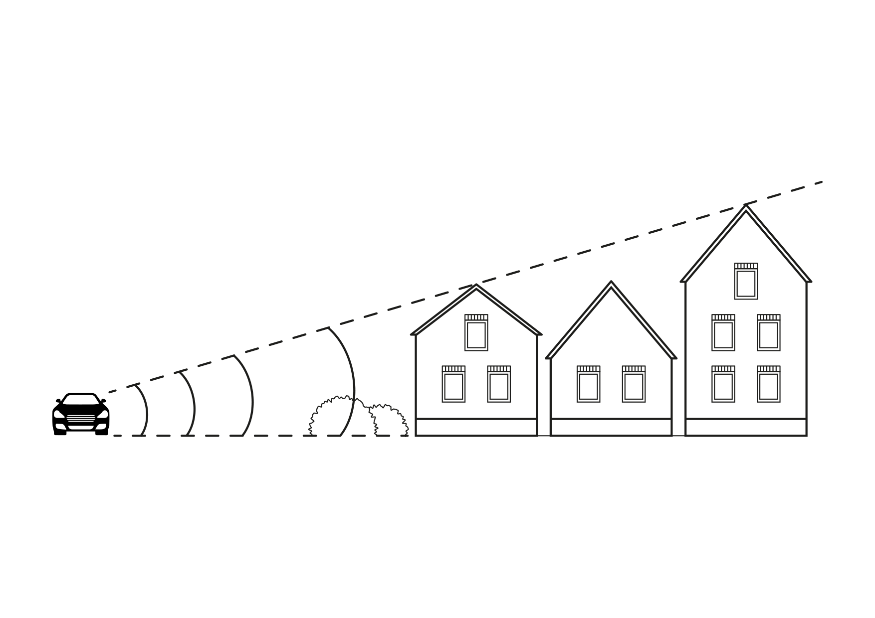
The Traffic Noise overlay is an Overlay which displays the impact of traffic noise in DB(A) for the project area. Based on traffic flow, distance and several computation parameters a grid is calculated for the project area. Note, this overlay only shows the impact of traffic noise on top of a background value of 48 dB(A). Influence of other sources (e.g. windmills, air traffic, factories, etc) is excluded.
Adding and removing
To add a traffic noise overlay go to the Overlays menu in the GEO DATA ribbon and select Add Traffic Noise. To remove the overlay, press Remove below the overlays list.
Calculations
The calculations follow the standard rekenmethode 1 (SRM 1), as described on [1]:
LAeq = E + Co + Cr - Da - Dl - Db - Dm
where:
- LAeq: equivalent noise level (dB(A))
- E: emission
- Co: acceleration term (default = XXX dB(A))
- Cr: reflection term (omitted)
- Da: distance reduction
- Dl: air reduction (default = XXX dB(A))
- Db: surface reduction (default = XXX dB(A))
- Dm: meteorological reduction (default = XXX dB(A))
Default values are taken from InfoMil [2]
Emission
Emission is computed as:
E = 10 * log(10^(Elv/10)+10^(Emv/10)+10^(Ezv/10)
Per vehicle category, the emission is computed as:
Em = am + bm * log(m/v0) + 10 * log(Q/vm)+Cw;m
and
Cw;m = σm + τm x log(vm/v0,m)
where:
- m: vehicle category (light weihgt, medium weight and heavy)
- a and b: factors to be found at InfoMil [3]
- Cw = road surface correction
- σ = correction factor at reference traffic speed
- τ = correction factor per 10 km/hour deviation from reference traffic speed
Distance reduction
Distance reduction is computed as:
Da = 10 * log(r)
where:
- Da: distance reduction
- r: shortest distance between the source and point of evaluation
References
The overlay calculations are based on Standard Calculation Method 1 (SRM1) as defined by the dutch government: wetten.overheid.nl


