How to select a GeoTIFF: Difference between revisions
Jump to navigation
Jump to search
(Created page with "For some components in the {{software}} a GeoTiff can be selected as (input) data. {{editor steps|title=select an existing GeoTiff |Select the option to select or use a GeoTi...") |
mNo edit summary |
||
| Line 1: | Line 1: | ||
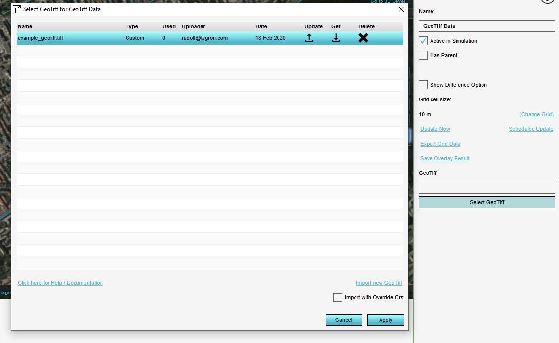
[[File:Geotiff overlay geotiff manager.jpg|right|thumb|400px|Geotiff Manager.]] | |||
For some components in the {{software}} a GeoTiff can be selected as (input) data. | For some components in the {{software}} a GeoTiff can be selected as (input) data. | ||
Revision as of 13:32, 18 February 2020
For some components in the Tygron Platform a GeoTiff can be selected as (input) data.
How to select an existing GeoTiff:
- Select the option to select or use a GeoTiff, for the applicable component. This will open the GeoTiff Manager.
- If the GeoTiff you wish to use is not yet loaded, select the "Import new GeoTiff" option, and select the desired GeoTiff.
- In the GeoTiff Manager, select the GeoTiff you wish to use.
- Select "Apply".
- The GeoTiff is now used as data or input for your component.
