Spatial plan: Difference between revisions
| Line 15: | Line 15: | ||
==How to import a spatial plan== | ==How to import a spatial plan== | ||
==Visualization options== | ==Visualization options== | ||
Revision as of 17:22, 24 January 2023
A spatial plan is a design of an area with focus on the landscape, environment, routing, the interaction between public and private space, buildings forms, materialization and more. This design can be made for an urban area as part of an urban planning project or for a more rural area for a landscape design or land art project. Spatial plans are created by urban designers or landscape architects and can have different scales and therefore different level of detail.
The Tygron Platform can be used for importing spatial plans to evaluate certain design measures in a plan, for example if the parking standard is feasible.
Requirements on a spatial plan
In principle every spatial plan can be imported, as long as the original format of the drawing can be converted to any of the supported file formats. Take into account that the level of detail in the Tygron Platform does not include interior designs.
There are some requirements on a the spatial plan before importing it into the Tygron Platform.
- Geometries: Features from a spatial plan are required to have a geometry to define its spatial shape and location.
- Coordinate system: Choose a coordinate reference system for your drawing and draw and scale the plan on the right location on the planet. The most used coordinate system in the Netherlands is Amersfoort/RD New (EPSG:28992). Without a correct location, the drawing could be anywhere on the planet and not possible to import in any spatial software on the right location.
- Layer naming: Features can be grouped together in layers. For example: offices are drawn in the layer offices, while student houses are drawn in the layer student houses. The layer name can be used for classification.
- Attributes: Attributes can also be assigned to Features, optionally with a specific value. These can be used for classification.
How to import a spatial plan
Visualization options
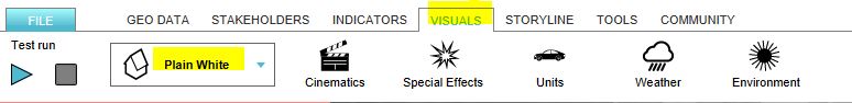
Depending on the use case, it may be better to use placeholders for buildings to emphasize the design phase in the project. Therefore it might be fitting to show the 3D world and the spatial plan in plain white colors with no windows, doors etc. To do this, go in the Editor interface to Visuals and choose the Plain White option.
Texture options.
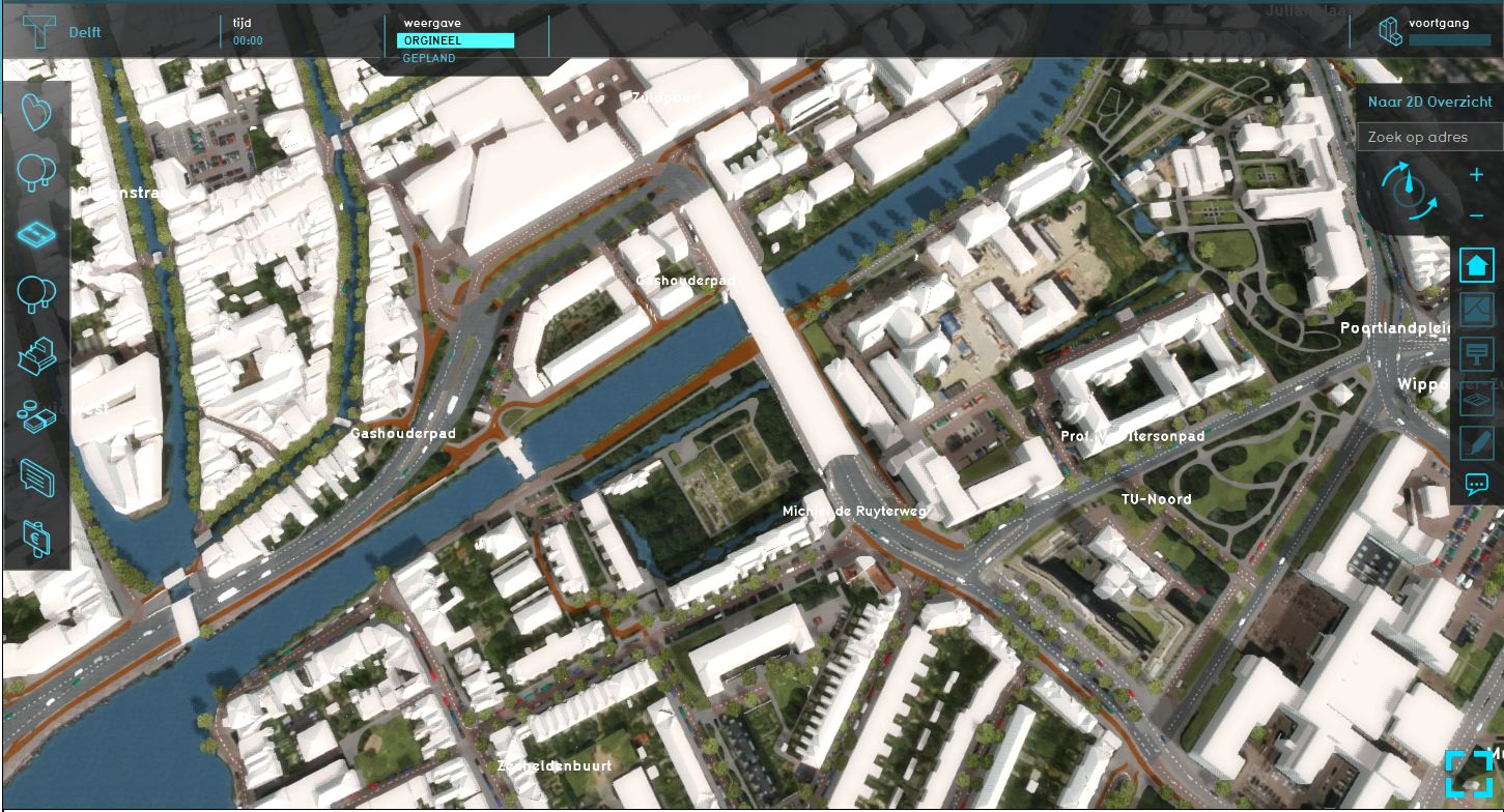
Plain white texture for buildings.
