WFS
What is a WFS
A Web Feature Service, in short WFS, is a standard in where data is published to the Internet and can be downloaded in different (geo) data formats. This standard is defined by the OGC, the Open Geospatial Consortium. The data is accessible through an URL and works in any browser. To read the metadata, filter data or download it, you can just use your browser. To visualize the data, the URL of the WFS can be read by a GIS (Geographical Information System). One of the advantages of a WFS is that the data is accessible on the internet, so you can always access it (if there is internet) and you don’t have to carry files with you anymore. Also sharing data is more easily, since you just have to provide the WFS URL, instead of the data file.
How to insert a WFS in the Tygron Platform
There are already a few WFS provided by default to load data from. These are already used by the Tygron Platform, among other datasets, to create a new project with.
- BAG: the base registration for Addresses and Buildings in the Netherlands.
- BRP: Gewaspercelen, a Dutch dataset containing the type of crops.
- CBS Buurten: CBS Wijk en Buurtkaart; a Dutch dataset from the CBS containing the geometries of neighborhoods in the Netherlands and statistical data about these neighborhoods.
- FGR: Fysisch geografische regio's; a Dutch dataset containing the types of land
It is also possible to provide your own WFS. This WFS must conform to the following requirement before it can be loaded properly into the Tygron Platform:
- The WFS must have either GML3 or GeoJSON as output format.
The WFS can be loaded in the Tygron Platform by using the Geo Data Wizard. Choose the second option: "Loading data from a Feature Service". In the next step, you will be asked to provide a name and the URL for the WFS. If the WFS is published through ArcGIS server (Arcgis is then part of the URL), choose ESRI_JSON as output type, otherwise choose WFS_JSON.
- Choose a name for the WFS
- Provinde the URL of the WFS (the GetCapabilities part can be omitted)
- If the WFS is published through ArcGIS server, choose ESRI_JSON, otherwise choose WFS_JSON
How to edit or remove a WFS URL
- Select in the editor Current situation
- Hover over 'Geo Import' from the ribbon bar
- Select 'Show Project Sources'
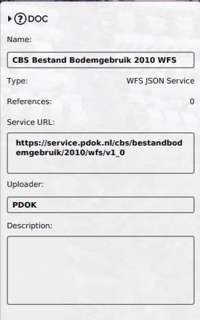
- Select the desired connection you wish to edit
- In the panel on the right, edit the name, URL, Uploader and/or description
- Select in the editor Current situation
- Hover over 'Geo Import' from the ribbon bar
- Select 'Show Project Sources'
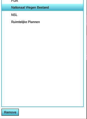
- Select the desired connection you wish to remove
- Click on the button 'Remove' at the bottom left corner
Read more
This [[1]] video shows how to edit data in the Tygron Platform externally through wfs

